Area Overview for SG8 8QR
Photos of SG8 8QR
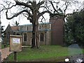
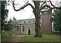
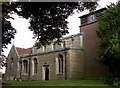
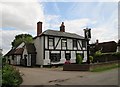
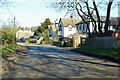
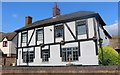
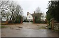
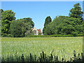
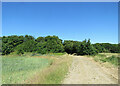
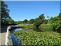
44 photos from this area
Area Information
Key information about the SG8 8QR including its size, population, and administrative classification.
- Area Type
- Postcode
- Area Size
- 84.3 hectares
- Population
- 1563
- Population Density
- 46 people/km²
House Prices in SG8 8QR
18
Properties
£832,500
Average Sold Price
£210,000
Lowest Price
£1,600,000
Highest Price
Showing 18 properties
| Address | Type | Beds | Baths | Last Sale Price | Last Sale Date | |
|---|---|---|---|---|---|---|
| Camps Cottage, Broad Green, Chrishall, SG8 8QR | Detached | 5 | 3 | £620,000 | Jul 2025 | |
| Cedar House, Broad Green, Chrishall, SG8 8QR | house | - | - | £900,000 | Aug 2022 | |
| Broad Green Farm, Broad Green, Chrishall, SG8 8QR | Terraced | - | - | £1,600,000 | Jul 2013 | |
| Springfields, Broad Green, Chrishall, SG8 8QR | Detached | 6 | 2 | £210,000 | Oct 1997 | |
| Annexe At Cedar House, Broad Green, Chrishall, SG8 8QR | Detached | - | - | - | - | |
| Green End, Broad Green, Chrishall, SG8 8QR | undefined | - | - | - | - | |
| House, Broad Green, Chrishall, SG8 8QR | undefined | - | - | - | - | |
| End Cottage, Broad Green, Chrishall, SG8 8QR | undefined | - | - | - | - | |
| Annexe At, Sawkins Cottage, Broad Green, Chrishall, SG8 8QR | house | - | - | - | - | |
| Pump House 17M From, Cedar House, Broad Green, Chrishall, SG8 8QR | Flat | - | - | - | - |
Page 1 of 2
Energy Efficiency in SG8 8QR
Amenities
Schools
| Rank | School | Type | Entry gender | Ages |
|---|
Explore more schools in this area
Go to Schools tabDemographics
Household Size
Two person
most common
Accommodation Type
Houses
most common
Tenure
76
majority
Ethnic Group
White
most common
Religion
N/A
most common
Household Composition
N/A
most common
Age
47
median
Adults (30-64 years)
most common
Household Deprivation
N/A
with no deprivation
NS-SEC
51
in Lower managerial occupations
Explore more demographic insights in this area
Go to Demographics tabPlanning
Planning Constraints
- Flood RiskPremium
- Ramsar Wetland SitesPremium
- Area of Outstanding Natural BeautyPremium
- Protected Nature ReservePremium
- Protected WoodlandPremium