Area Overview for SG8 8QL
Photos of SG8 8QL
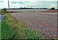
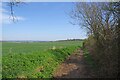
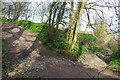
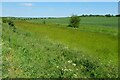
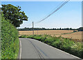
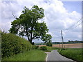
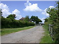
11 photos from this area
Area Information
Key information about the SG8 8QL including its size, population, and administrative classification.
- Area Type
- Postcode
- Area Size
- 27.7 hectares
- Population
- 1563
- Population Density
- 46 people/km²
House Prices in SG8 8QL
35
Properties
£284,087
Average Sold Price
£45,360
Lowest Price
£510,000
Highest Price
Showing 35 properties
| Address | Type | Beds | Baths | Last Sale Price | Last Sale Date | |
|---|---|---|---|---|---|---|
| 3 Crawley End Road, Chrishall, SG8 8QL | Semi-detached | 2 | 1 | £392,500 | Sep 2023 | |
| Tall Trees, Crawley End Road, Chrishall, SG8 8QL | house | 3 | - | £510,000 | Jul 2022 | |
| 11 Crawley End Road, Chrishall, SG8 8QL | house | - | - | £397,000 | Oct 2019 | |
| 1 Crawley End Road, Chrishall, SG8 8QL | house | - | - | £330,000 | Oct 2018 | |
| 28 Crawley End Road, Chrishall, SG8 8QL | Semi-detached | 3 | - | £349,950 | Jul 2017 | |
| 23 Crawley End Road, Chrishall, SG8 8QL | Semi-detached | 3 | 2 | £436,000 | Jun 2017 | |
| 9 Crawley End Road, Chrishall, SG8 8QL | Semi-detached | 3 | - | £275,000 | Feb 2014 | |
| 21 Crawley End Road, Chrishall, SG8 8QL | Detached | 3 | - | £235,000 | Sep 2013 | |
| 24 Crawley End Road, Chrishall, SG8 8QL | house | 3 | - | £260,000 | Feb 2011 | |
| 19 Crawley End Road, Chrishall, SG8 8QL | house | - | - | £235,000 | Oct 2009 |
Page 1 of 4
Energy Efficiency in SG8 8QL
Amenities
Schools
| Rank | School | Type | Entry gender | Ages |
|---|
Explore more schools in this area
Go to Schools tabDemographics
Household Size
Two person
most common
Accommodation Type
Houses
most common
Tenure
76
majority
Ethnic Group
White
most common
Religion
N/A
most common
Household Composition
N/A
most common
Age
47
median
Adults (30-64 years)
most common
Household Deprivation
N/A
with no deprivation
NS-SEC
51
in Lower managerial occupations
Explore more demographic insights in this area
Go to Demographics tabPlanning
Planning Constraints
- Flood RiskPremium
- Ramsar Wetland SitesPremium
- Area of Outstanding Natural BeautyPremium
- Protected Nature ReservePremium
- Protected WoodlandPremium