Area Overview for CB11 4NH
Photos of CB11 4NH
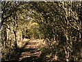
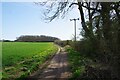
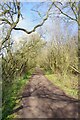
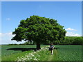
35 photos from this area
Area Information
Key information about the CB11 4NH including its size, population, and administrative classification.
- Area Type
- Postcode
- Area Size
- 32.8 hectares
- Population
- 1563
- Population Density
- 46 people/km²
House Prices in CB11 4NH
11
Properties
£602,750
Average Sold Price
£475,000
Lowest Price
£725,000
Highest Price
Showing 11 properties
| Address | Type | Beds | Baths | Last Sale Price | Last Sale Date | |
|---|---|---|---|---|---|---|
| White Cottage, Heydon Lane, Elmdon, CB11 4NH | Detached | 4 | 2 | £661,000 | Nov 2019 | |
| Shorthorns Barn, Heydon Lane, Elmdon, CB11 4NH | Detached | - | - | £550,000 | Apr 2010 | |
| Paddocks House, Heydon Lane, Elmdon, CB11 4NH | Detached | - | - | £725,000 | Apr 2003 | |
| Harvest Barn, Heydon Lane, Elmdon, CB11 4NH | Detached | - | - | £475,000 | Apr 2001 | |
| The Maltings, Heydon Lane, Elmdon, CB11 4NH | Leisure | - | - | - | - | |
| Whitehall, Heydon Lane, Elmdon, CB11 4NH | Detached | - | - | - | - | |
| Frondirion, Heydon Lane, Elmdon, CB11 4NH | Terraced | - | - | - | - | |
| The Annexe, Elmdon Barn, Heydon Lane, Elmdon, CB11 4NH | Flat | - | - | - | - | |
| Elmdon Barn, Heydon Lane, Elmdon, CB11 4NH | Detached | - | - | - | - | |
| Elmdon Lodge, Heydon Lane, Elmdon, CB11 4NH | house | - | - | - | - |
Page 1 of 2
Energy Efficiency in CB11 4NH
Amenities
Schools
| Rank | School | Type | Entry gender | Ages |
|---|
Explore more schools in this area
Go to Schools tabDemographics
Household Size
Two person
most common
Accommodation Type
Houses
most common
Tenure
76
majority
Ethnic Group
White
most common
Religion
N/A
most common
Household Composition
N/A
most common
Age
47
median
Adults (30-64 years)
most common
Household Deprivation
N/A
with no deprivation
NS-SEC
51
in Lower managerial occupations
Explore more demographic insights in this area
Go to Demographics tabPlanning
Planning Constraints
- Flood RiskPremium
- Ramsar Wetland SitesPremium
- Area of Outstanding Natural BeautyPremium
- Protected Nature ReservePremium
- Protected WoodlandPremium