Area Overview for SG5 2RA
Photos of SG5 2RA
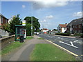
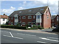
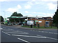
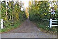
29 photos from this area
Area Information
Key information about the SG5 2RA including its size, population, and administrative classification.
- Area Type
- Postcode
- Area Size
- 7115 m²
- Population
- 1620
- Population Density
- 2997 people/km²
House Prices in SG5 2RA
18
Properties
£218,667
Average Sold Price
£108,000
Lowest Price
£384,000
Highest Price
Showing 18 properties
| Address | Type | Beds | Baths | Last Sale Price | Last Sale Date | |
|---|---|---|---|---|---|---|
| 55 Swinburne Avenue, Hitchin, SG5 2RA | Flat | 2 | 1 | £225,000 | May 2022 | |
| 49 Swinburne Avenue, Hitchin, SG5 2RA | Maisonette | 2 | 1 | £212,000 | Feb 2022 | |
| 56 Swinburne Avenue, Hitchin, SG5 2RA | Semi-detached | 3 | - | £384,000 | Aug 2020 | |
| 63 Swinburne Avenue, Hitchin, SG5 2RA | Flat | - | - | £232,000 | Aug 2018 | |
| 51 Swinburne Avenue, Hitchin, SG5 2RA | Maisonette | 2 | - | £210,000 | May 2017 | |
| 65 Swinburne Avenue, Hitchin, SG5 2RA | house | - | - | £180,000 | Oct 2010 | |
| 54 Swinburne Avenue, Hitchin, SG5 2RA | Semi-detached | - | - | £200,000 | Dec 2008 | |
| 62 Swinburne Avenue, Hitchin, SG5 2RA | Terraced | - | - | £217,000 | Mar 2007 | |
| 45 Swinburne Avenue, Hitchin, SG5 2RA | Semi-detached | - | - | £108,000 | Nov 1999 | |
| 60 Swinburne Avenue, Hitchin, SG5 2RA | house | - | - | - | - |
Page 1 of 2
Energy Efficiency in SG5 2RA
Amenities
Schools
| Rank | School | Type | Entry gender | Ages |
|---|
Explore more schools in this area
Go to Schools tabDemographics
Household Size
One person
most common
Accommodation Type
Flats
most common
Tenure
31
majority
Ethnic Group
White
most common
Religion
N/A
most common
Household Composition
N/A
most common
Age
47
median
Adults (30-64 years)
most common
Household Deprivation
N/A
with no deprivation
NS-SEC
21
in Lower managerial occupations
Explore more demographic insights in this area
Go to Demographics tabPlanning
Planning Constraints
- Flood RiskPremium
- Ramsar Wetland SitesPremium
- Area of Outstanding Natural BeautyPremium
- Protected Nature ReservePremium
- Protected WoodlandPremium