Area Overview for SG5 1SL
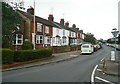
Photos of SG5 1SL


Area Information
Living in SG5 1SL means residing in a highly specific residential cluster defined by its postcode rather than a sprawling district. This exact area covers 8648 m² and contains a population of 1396 people. The result is a tightly knit community where the local environment is intimate and the community size remains stable with a population density of 161426 people per km². You will find a neighbourhood that prioritises settled living rather than commercial bustle. The layout supports a quiet daily life where residents have immediate access to their surroundings without navigating broad urban landscapes. The area functions as a distinct pocket within the wider region, offering a focused residential experience. When you look at the map, you see a concentrated zone designed primarily for housing rather than mixed-use development. This concentration creates a defined character that differentiates it from neighbouring postal sectors. The small footprint ensures that facilities are within easy reach for anyone who calls SG5 1SL home. You gain a home situated in a setting where the scale of the environment matches the scale of the community.
- Area Type
- Postcode
- Area Size
- 8648 m²
- Population
- 1396
- Population Density
- 1745 people/km²
The property market for SG5 1SL is characterised by an almost exclusive focus on house ownership. With home ownership standing at 82%, you will find that very few properties are available for rent within the immediate cluster. The accommodation type is strictly Houses, meaning you will encounter detached, semi-detached, or terraced homes, but no flats or apartments are typical of this specific postcode. This makes SG5 1SL an ideal location for buyers seeking a traditional family home rather than a rental property suited for urban living. The low rental presence implies that the local market is driven by resale transactions and long-term residents. You are looking at a stock where sellers have likely lived in their homes for many years. This track record often correlates with well-maintained properties that have been cared for by the same owners. If you are considering purchasing, you will find a environment where mortgage buyers compete for the limited supply of houses rather than facing a competitive rental bidding war. The market dynamics here favour those with purchase finance over those seeking short-term accommodation solutions.
House Prices in SG5 1SL
Showing 15 properties
| Address | Type | Beds | Baths | Last Sale Price | Last Sale Date | |
|---|---|---|---|---|---|---|
| 7 Strathmore Avenue, Hitchin, SG5 1SL | Semi-detached | 3 | 2 | £700,000 | May 2025 | |
| 18 Strathmore Avenue, Hitchin, SG5 1SL | Semi-detached | 5 | 2 | £950,000 | Oct 2023 | |
| 16 Strathmore Avenue, Hitchin, SG5 1SL | house | 4 | 2 | £850,000 | May 2023 | |
| 8 Strathmore Avenue, Hitchin, SG5 1SL | house | - | - | £450,000 | Jun 2019 | |
| 11 Strathmore Avenue, Hitchin, SG5 1SL | house | - | - | £567,500 | Mar 2015 | |
| 6 Strathmore Avenue, Hitchin, SG5 1SL | Semi-detached | - | - | £72,000 | May 1996 | |
| 5 Strathmore Avenue, Hitchin, SG5 1SL | Semi-detached | 3 | 1 | £79,000 | Feb 1996 | |
| 10 Strathmore Avenue, Hitchin, SG5 1SL | Detached | 4 | 2 | - | - | |
| 13 Strathmore Avenue, Hitchin, SG5 1SL | house | 3 | 1 | - | - | |
| 12 Strathmore Avenue, Hitchin, SG5 1SL | Terraced | - | - | - | - |
Energy Efficiency in SG5 1SL
Daily life in SG5 1SL is supported by a cluster of amenities that fall within practical reach of the local residents. For your shopping needs, you can access Asda Nightingale, Sainsburys Hitchin, and Tesco Hitchin, ensuring you have multiple options for groceries and household supplies. These retail locations offer the convenience of daily necessities without requiring a lengthy journey into the city centre. For those who prefer to travel by foot or car for additional options, the area is close to five major railway stations including Hitchin, Letchworth, Baldock, and others nearby. This rail connectivity means you can easily commute to London or other business hubs without needing a private vehicle for every trip. The combination of local supermarkets and frequent train services creates a balanced lifestyle where you enjoy local convenience while maintaining access to wider opportunities. You do not have to choose between a quiet rural setting and a well-connected location because both elements are present in SG5 1SL. The proximity to these key destinations defines the rhythm of life for anyone living in this postcode area.
Amenities
Schools
Families in SG5 1SL have several educational options immediately within their reach, covering different focuses in learning and care. The area is served by Strathmore Infant and Nursery School, which holds a good Ofsted rating and caters to younger children. You also have access to Our Lady Roman Catholic Primary School and Our Lady Catholic Primary School, both of which are primary institutions that provide schooling for the early years of education. For children with specific special educational needs, The Chrysalis School for Autism is available to support families requiring specialist care. The mix of standard primary schools and a dedicated special school ensures that the area caters to a broad spectrum of educational requirements. While you do not have secondary schools listed directly in the immediate vicinity of this postcode, the presence of highly rated primary providers gives families confidence in the early stages of a child's education. You will find that the local education infrastructure supports normal classroom learning as well as special needs development. This variety means parents can choose schools based on their child's needs rather than being limited to a single option.
| Rank | School | Type | Entry gender | Ages |
|---|
Explore more schools in this area
Go to Schools tabDemographics
The community in SG5 1SL displays a clear demographic profile centred on stability and ownership. You will find that 82% of households are owner-occupied, which signifies a strong tendency for residents to settle permanently rather than rent temporarily. The predominant form of accommodation consists of houses, reflecting a preference for detached or semi-detached living over flats or apartments. The resident population leans towards middle and senior age groups, with the most common age range falling between 30 and 64 years. The median age for people living in this postcode is 47, indicating a mature demographic that has often raised children and now enjoys greater financial security. The area is also overwhelmingly White, which matches the broader national trend for English counties. You will not encounter significant deprivation markers within this specific postcode area. The combination of high ownership rates and a predominantly household-owned stock suggests a community that values long-term investment in their local property. Families with older children or empty nesters likely form the core of this demographic structure.
Household Size
Accommodation Type
Tenure
Ethnic Group
Religion
Household Composition
Age
Household Deprivation
NS-SEC
Explore more demographic insights in this area
Go to Demographics tabPlanning
Planning Constraints
- Flood RiskPremium
- Ramsar Wetland SitesPremium
- Area of Outstanding Natural BeautyPremium
- Protected Nature ReservePremium
- Protected WoodlandPremium