Area Overview for SG4 7SN
Photos of SG4 7SN
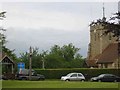
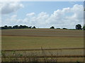
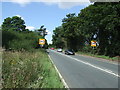
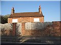
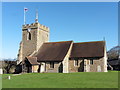
32 photos from this area
Area Information
Key information about the SG4 7SN including its size, population, and administrative classification.
- Area Type
- Postcode
- Area Size
- 3.7 hectares
- Population
- 2062
- Population Density
- 2852 people/km²
House Prices in SG4 7SN
43
Properties
£387,142
Average Sold Price
£145,000
Lowest Price
£735,000
Highest Price
Showing 43 properties
| Address | Type | Beds | Baths | Last Sale Price | Last Sale Date | |
|---|---|---|---|---|---|---|
| 11 Sycamore Close, Hitchin, SG4 7SN | Detached | 4 | 2 | £735,000 | Nov 2024 | |
| 43 Sycamore Close, Hitchin, SG4 7SN | house | - | - | £700,000 | Mar 2021 | |
| 15 Sycamore Close, Hitchin, SG4 7SN | Detached | 4 | - | £642,500 | Feb 2021 | |
| 41 Sycamore Close, Hitchin, SG4 7SN | Detached | 4 | 2 | £668,000 | Jun 2020 | |
| 25 Sycamore Close, Hitchin, SG4 7SN | Detached | 4 | - | £670,000 | Aug 2018 | |
| 24 Sycamore Close, Hitchin, SG4 7SN | Detached | 4 | - | £715,000 | Jul 2018 | |
| 19 Sycamore Close, Hitchin, SG4 7SN | Detached | 4 | 2 | £645,000 | Jun 2018 | |
| 2 Sycamore Close, Hitchin, SG4 7SN | house | - | - | £690,000 | Sep 2017 | |
| 32 Sycamore Close, Hitchin, SG4 7SN | house | - | - | £600,000 | Aug 2017 | |
| 16 Sycamore Close, Hitchin, SG4 7SN | house | - | - | £590,000 | Mar 2016 |
Page 1 of 5
Energy Efficiency in SG4 7SN
Amenities
Schools
| Rank | School | Type | Entry gender | Ages |
|---|
Explore more schools in this area
Go to Schools tabDemographics
Household Size
Family (3-5 people)
most common
Accommodation Type
Houses
most common
Tenure
88
majority
Ethnic Group
White
most common
Religion
N/A
most common
Household Composition
N/A
most common
Age
47
median
Adults (30-64 years)
most common
Household Deprivation
N/A
with no deprivation
NS-SEC
60
in Lower managerial occupations
Explore more demographic insights in this area
Go to Demographics tabPlanning
Planning Constraints
- Flood RiskPremium
- Ramsar Wetland SitesPremium
- Area of Outstanding Natural BeautyPremium
- Protected Nature ReservePremium
- Protected WoodlandPremium