Area Overview for SG4 0EX
Photos of SG4 0EX

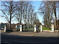
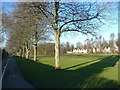
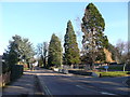

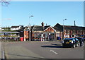
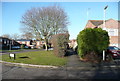
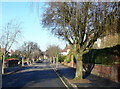
98 photos from this area
Area Information
Key information about the SG4 0EX including its size, population, and administrative classification.
- Area Type
- Postcode
- Area Size
- 1.5 hectares
- Population
- 1361
- Population Density
- 3531 people/km²
House Prices in SG4 0EX
44
Properties
£151,124
Average Sold Price
£35,000
Lowest Price
£552,500
Highest Price
Showing 44 properties
| Address | Type | Beds | Baths | Last Sale Price | Last Sale Date | |
|---|---|---|---|---|---|---|
| 38 Wedgewood Road, Hitchin, SG4 0EX | Flat | 1 | 1 | £168,500 | Jun 2025 | |
| 27 Wedgewood Road, Hitchin, SG4 0EX | Flat | 1 | 1 | £170,000 | Aug 2024 | |
| 43 Wedgewood Road, Hitchin, SG4 0EX | Flat | 1 | 1 | £185,000 | Jan 2023 | |
| 11 Wedgewood Road, Hitchin, SG4 0EX | Flat | 1 | 1 | £145,000 | May 2022 | |
| 12 Wedgewood Road, Hitchin, SG4 0EX | Flat | - | - | £157,000 | Jan 2022 | |
| 35 Wedgewood Road, Hitchin, SG4 0EX | Flat | - | - | £225,000 | Dec 2021 | |
| 25 Wedgewood Road, Hitchin, SG4 0EX | Flat | 1 | 1 | £145,000 | Jul 2021 | |
| 40 Wedgewood Road, Hitchin, SG4 0EX | Flat | - | - | £215,000 | Sep 2020 | |
| 18 Wedgewood Road, Hitchin, SG4 0EX | Flat | - | - | £122,000 | Nov 2018 | |
| 9 Wedgewood Road, Hitchin, SG4 0EX | Flat | - | - | £175,000 | Sep 2018 |
Page 1 of 5
Energy Efficiency in SG4 0EX
Amenities
Schools
| Rank | School | Type | Entry gender | Ages |
|---|
Explore more schools in this area
Go to Schools tabDemographics
Household Size
Family (3-5 people)
most common
Accommodation Type
Houses
most common
Tenure
80
majority
Ethnic Group
White
most common
Religion
N/A
most common
Household Composition
N/A
most common
Age
47
median
Adults (30-64 years)
most common
Household Deprivation
N/A
with no deprivation
NS-SEC
62
in Lower managerial occupations
Explore more demographic insights in this area
Go to Demographics tabPlanning
Planning Constraints
- Flood RiskPremium
- Ramsar Wetland SitesPremium
- Area of Outstanding Natural BeautyPremium
- Protected Nature ReservePremium
- Protected WoodlandPremium