Area Overview for SG4 0ET
Photos of SG4 0ET

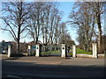
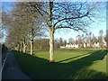
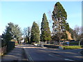

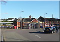
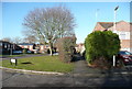
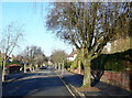
98 photos from this area
Area Information
Key information about the SG4 0ET including its size, population, and administrative classification.
- Area Type
- Postcode
- Area Size
- 6023 m²
- Population
- 1361
- Population Density
- 3531 people/km²
House Prices in SG4 0ET
15
Properties
£286,844
Average Sold Price
£83,000
Lowest Price
£495,000
Highest Price
Showing 15 properties
| Address | Type | Beds | Baths | Last Sale Price | Last Sale Date | |
|---|---|---|---|---|---|---|
| 1 Mermaid Close, Hitchin, SG4 0ET | house | 3 | 2 | £495,000 | Jan 2025 | |
| 9 Mermaid Close, Hitchin, SG4 0ET | Terraced | 3 | 2 | £430,000 | Aug 2022 | |
| 8 Mermaid Close, Hitchin, SG4 0ET | house | - | - | £360,000 | Mar 2021 | |
| 14 Mermaid Close, Hitchin, SG4 0ET | house | - | - | £400,000 | Jan 2021 | |
| 7 Mermaid Close, Hitchin, SG4 0ET | Terraced | 3 | 1 | £352,500 | Apr 2018 | |
| 10 Mermaid Close, Hitchin, SG4 0ET | Terraced | 3 | 1 | £380,000 | Mar 2018 | |
| 6 Mermaid Close, Hitchin, SG4 0ET | Terraced | 3 | 2 | £406,666 | Sep 2016 | |
| 11 Mermaid Close, Hitchin, SG4 0ET | Terraced | 3 | 2 | £360,000 | Jun 2016 | |
| 3 Mermaid Close, Hitchin, SG4 0ET | Terraced | 3 | 1 | £230,000 | Nov 2011 | |
| 4 Mermaid Close, Hitchin, SG4 0ET | house | - | - | £230,000 | Oct 2011 |
Page 1 of 2
Energy Efficiency in SG4 0ET
Amenities
Schools
| Rank | School | Type | Entry gender | Ages |
|---|
Explore more schools in this area
Go to Schools tabDemographics
Household Size
Family (3-5 people)
most common
Accommodation Type
Houses
most common
Tenure
80
majority
Ethnic Group
White
most common
Religion
N/A
most common
Household Composition
N/A
most common
Age
47
median
Adults (30-64 years)
most common
Household Deprivation
N/A
with no deprivation
NS-SEC
62
in Lower managerial occupations
Explore more demographic insights in this area
Go to Demographics tabPlanning
Planning Constraints
- Flood RiskPremium
- Ramsar Wetland SitesPremium
- Area of Outstanding Natural BeautyPremium
- Protected Nature ReservePremium
- Protected WoodlandPremium