Area Overview for SG19 2NH
Photos of SG19 2NH
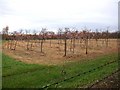
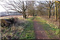
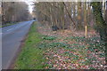
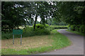
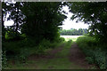
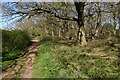
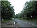
7 photos from this area
Area Information
Key information about the SG19 2NH including its size, population, and administrative classification.
- Area Type
- Postcode
- Area Size
- 2.9 km²
- Population
- 1821
- Population Density
- 234 people/km²
House Prices in SG19 2NH
19
Properties
£618,833
Average Sold Price
£370,000
Lowest Price
£765,000
Highest Price
Showing 19 properties
| Address | Type | Beds | Baths | Last Sale Price | Last Sale Date | |
|---|---|---|---|---|---|---|
| Silver Birches, Deepdale, Potton, SG19 2NH | Retail | 3 | - | £688,000 | Jan 2023 | |
| Deepdale Lodge, Deepdale, Potton, SG19 2NH | Detached | 4 | 5 | £765,000 | Aug 2021 | |
| Dirok, Deepdale, Potton, SG19 2NH | Bungalow | 5 | 2 | £600,000 | Feb 2020 | |
| 5 Deepdale, Potton, SG19 2NH | Detached | 4 | 2 | £680,000 | Oct 2018 | |
| Westbury, Deepdale, Potton, SG19 2NH | Semi-detached | 3 | 1 | £610,000 | Dec 2017 | |
| The Old House, Deepdale, Potton, SG19 2NH | house | - | - | £370,000 | Jul 2011 | |
| 6 Deepdale, Potton, SG19 2NH | Detached | 4 | 2 | - | - | |
| Fortune Farm, Deepdale, Potton, SG19 2NH | undefined | - | - | - | - | |
| The Annexe, Mount Pleasant, Deepdale, Potton, SG19 2NH | house | - | - | - | - | |
| The Annexe, Warren Farm, Deepdale, Potton, SG19 2NH | Detached | - | - | - | - |
Page 1 of 2
Energy Efficiency in SG19 2NH
Amenities
Schools
| Rank | School | Type | Entry gender | Ages |
|---|
Explore more schools in this area
Go to Schools tabDemographics
Household Size
Family (3-5 people)
most common
Accommodation Type
Houses
most common
Tenure
57
majority
Ethnic Group
White
most common
Religion
N/A
most common
Household Composition
N/A
most common
Age
47
median
Adults (30-64 years)
most common
Household Deprivation
N/A
with no deprivation
NS-SEC
31
in Lower managerial occupations
Explore more demographic insights in this area
Go to Demographics tabPlanning
Planning Constraints
- Flood RiskPremium
- Ramsar Wetland SitesPremium
- Area of Outstanding Natural BeautyPremium
- Protected Nature ReservePremium
- Protected WoodlandPremium