Area Overview for SG19 2JU
Photos of SG19 2JU
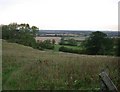

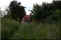
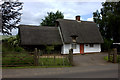

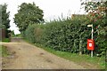
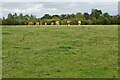
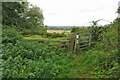
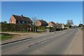
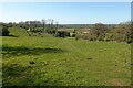
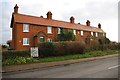
11 photos from this area
Area Information
Key information about the SG19 2JU including its size, population, and administrative classification.
- Area Type
- Postcode
- Area Size
- 72.3 hectares
- Population
- 2004
- Population Density
- 154 people/km²
House Prices in SG19 2JU
59
Properties
£312,075
Average Sold Price
£52,000
Lowest Price
£640,000
Highest Price
Showing 59 properties
| Address | Type | Beds | Baths | Last Sale Price | Last Sale Date | |
|---|---|---|---|---|---|---|
| 77 Sandy Road, Everton, SG19 2JU | Semi-detached | 2 | 1 | £181,500 | Apr 2025 | |
| 60 Sandy Road, Everton, SG19 2JU | house | - | - | £275,000 | Mar 2025 | |
| 7 Sandy Road, Everton, SG19 2JU | Cottage | 2 | 1 | £297,500 | Jun 2023 | |
| 21 Sandy Road, Everton, SG19 2JU | Detached | 3 | 1 | £400,000 | Apr 2023 | |
| 65 Sandy Road, Everton, SG19 2JU | house | - | - | £300,000 | Dec 2021 | |
| 19 Sandy Road, Everton, SG19 2JU | house | - | - | £485,000 | Sep 2021 | |
| 69 Sandy Road, Everton, SG19 2JU | Terraced | 4 | - | £425,000 | Feb 2021 | |
| 63 Sandy Road, Everton, SG19 2JU | Terraced | 3 | 1 | £379,995 | Jan 2020 | |
| 39 Sandy Road, Everton, SG19 2JU | house | - | - | £325,000 | Jan 2020 | |
| 72 Sandy Road, Everton, SG19 2JU | Terraced | 4 | - | £270,000 | Feb 2019 |
Page 1 of 6
Energy Efficiency in SG19 2JU
Amenities
Schools
| Rank | School | Type | Entry gender | Ages |
|---|
Explore more schools in this area
Go to Schools tabDemographics
Household Size
Two person
most common
Accommodation Type
Houses
most common
Tenure
66
majority
Ethnic Group
White
most common
Religion
N/A
most common
Household Composition
N/A
most common
Age
47
median
Adults (30-64 years)
most common
Household Deprivation
N/A
with no deprivation
NS-SEC
38
in Lower managerial occupations
Explore more demographic insights in this area
Go to Demographics tabPlanning
Planning Constraints
- Flood RiskPremium
- Ramsar Wetland SitesPremium
- Area of Outstanding Natural BeautyPremium
- Protected Nature ReservePremium
- Protected WoodlandPremium