Area Overview for SG19 1BP
Photos of SG19 1BP
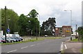
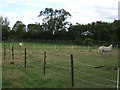
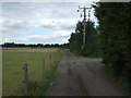
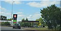
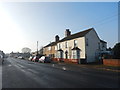


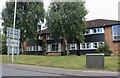
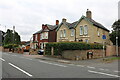
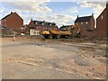
20 photos from this area
Area Information
Key information about the SG19 1BP including its size, population, and administrative classification.
- Area Type
- Postcode
- Area Size
- 1.7 hectares
- Population
- 1669
- Population Density
- 6902 people/km²
House Prices in SG19 1BP
39
Properties
£248,158
Average Sold Price
£82,500
Lowest Price
£499,950
Highest Price
Showing 39 properties
| Address | Type | Beds | Baths | Last Sale Price | Last Sale Date | |
|---|---|---|---|---|---|---|
| 135 St Neots Road, Sandy, SG19 1BP | Cottage | 2 | 1 | £270,000 | Jul 2025 | |
| 131 St Neots Road, Sandy, SG19 1BP | Semi-detached | 2 | 1 | £280,000 | Sep 2023 | |
| 127 St Neots Road, Sandy, SG19 1BP | Terraced | 2 | 1 | £275,000 | Oct 2022 | |
| 95 St Neots Road, Sandy, SG19 1BP | Semi-detached | 4 | 1 | £440,000 | Aug 2022 | |
| 139 St Neots Road, Sandy, SG19 1BP | Retail | 4 | 2 | £352,500 | May 2022 | |
| 89 St Neots Road, Sandy, SG19 1BP | Bungalow | 4 | - | £499,950 | Nov 2021 | |
| 83 St Neots Road, Sandy, SG19 1BP | Semi-detached | 3 | 1 | £389,000 | Mar 2021 | |
| 109 St Neots Road, Sandy, SG19 1BP | Cottage | 2 | 1 | £195,000 | Dec 2018 | |
| 125 St Neots Road, Sandy, SG19 1BP | Terraced | 3 | 1 | £255,000 | Nov 2017 | |
| 99 St Neots Road, Sandy, SG19 1BP | Detached | 5 | 2 | £418,000 | Mar 2016 |
Page 1 of 4
Energy Efficiency in SG19 1BP
Amenities
Schools
| Rank | School | Type | Entry gender | Ages |
|---|
Explore more schools in this area
Go to Schools tabDemographics
Household Size
Family (3-5 people)
most common
Accommodation Type
Houses
most common
Tenure
70
majority
Ethnic Group
White
most common
Religion
N/A
most common
Household Composition
N/A
most common
Age
47
median
Adults (30-64 years)
most common
Household Deprivation
N/A
with no deprivation
NS-SEC
38
in Lower managerial occupations
Explore more demographic insights in this area
Go to Demographics tabPlanning
Planning Constraints
- Flood RiskPremium
- Ramsar Wetland SitesPremium
- Area of Outstanding Natural BeautyPremium
- Protected Nature ReservePremium
- Protected WoodlandPremium