Area Overview for SG19 1LQ
Photos of SG19 1LQ
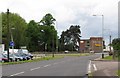
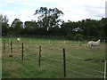
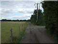
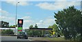
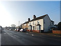

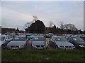
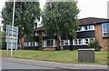
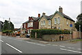
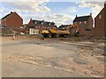
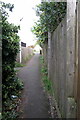
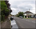
20 photos from this area
Area Information
Key information about the SG19 1LQ including its size, population, and administrative classification.
- Area Type
- Postcode
- Area Size
- 5619 m²
- Population
- 1669
- Population Density
- 6902 people/km²
House Prices in SG19 1LQ
18
Properties
£161,142
Average Sold Price
£75,000
Lowest Price
£275,000
Highest Price
Showing 18 properties
| Address | Type | Beds | Baths | Last Sale Price | Last Sale Date | |
|---|---|---|---|---|---|---|
| 100 St Neots Road, Sandy, SG19 1LQ | house | - | - | £275,000 | Jan 2023 | |
| 108 St Neots Road, Sandy, SG19 1LQ | Terraced | 3 | - | £228,000 | Jun 2021 | |
| 94 St Neots Road, Sandy, SG19 1LQ | Terraced | 2 | 1 | £236,700 | Jul 2019 | |
| 71 St Neots Road, Sandy, SG19 1LQ | Semi-detached | 2 | 2 | £230,000 | Sep 2017 | |
| 96 St Neots Road, Sandy, SG19 1LQ | Terraced | 2 | 1 | £185,000 | Oct 2015 | |
| 75 St Neots Road, Sandy, SG19 1LQ | Semi-detached | - | - | £173,000 | Aug 2005 | |
| 69 St Neots Road, Sandy, SG19 1LQ | Semi-detached | - | - | £130,000 | Oct 2004 | |
| 98 St Neots Road, Sandy, SG19 1LQ | Terraced | - | - | £117,000 | Feb 2003 | |
| 92 St Neots Road, Sandy, SG19 1LQ | house | 2 | - | £81,000 | May 2002 | |
| 102 St Neots Road, Sandy, SG19 1LQ | Terraced | - | - | £75,000 | Nov 2001 |
Page 1 of 2
Energy Efficiency in SG19 1LQ
Amenities
Schools
| Rank | School | Type | Entry gender | Ages |
|---|
Explore more schools in this area
Go to Schools tabDemographics
Household Size
Family (3-5 people)
most common
Accommodation Type
Houses
most common
Tenure
70
majority
Ethnic Group
White
most common
Religion
N/A
most common
Household Composition
N/A
most common
Age
47
median
Adults (30-64 years)
most common
Household Deprivation
N/A
with no deprivation
NS-SEC
38
in Lower managerial occupations
Explore more demographic insights in this area
Go to Demographics tabPlanning
Planning Constraints
- Flood RiskPremium
- Ramsar Wetland SitesPremium
- Area of Outstanding Natural BeautyPremium
- Protected Nature ReservePremium
- Protected WoodlandPremium