Area Overview for SG15 6SX
Photos of SG15 6SX
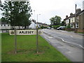
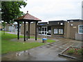
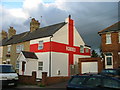
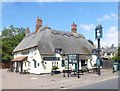
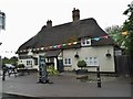
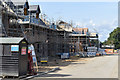
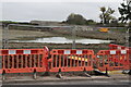
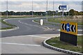
19 photos from this area
Area Information
Key information about the SG15 6SX including its size, population, and administrative classification.
- Area Type
- Postcode
- Area Size
- 3.4 hectares
- Population
- 2016
- Population Density
- 1042 people/km²
House Prices in SG15 6SX
32
Properties
£328,507
Average Sold Price
£67,000
Lowest Price
£720,000
Highest Price
Showing 32 properties
| Address | Type | Beds | Baths | Last Sale Price | Last Sale Date | |
|---|---|---|---|---|---|---|
| 129 High Street, Arlesey, SG15 6SX | Semi-detached | - | - | £570,000 | Oct 2025 | |
| 145 High Street, Arlesey, SG15 6SX | Semi-detached | 3 | 1 | £378,000 | Oct 2022 | |
| Gothic Farm, 153 High Street, Arlesey, SG15 6SX | Detached | 4 | 2 | £720,000 | Jul 2022 | |
| 147 High Street, Arlesey, SG15 6SX | house | - | - | £386,100 | Jun 2022 | |
| Moorlands Farm, 119 High Street, Arlesey, SG15 6SX | Detached | 5 | 2 | £695,000 | Sep 2020 | |
| 139 High Street, Arlesey, SG15 6SX | Semi-detached | 3 | 1 | £484,999 | Oct 2017 | |
| 137 High Street, Arlesey, SG15 6SX | house | 3 | 1 | £432,499 | Aug 2017 | |
| 4, Coach House Mews, 121 High Street, Arlesey, SG15 6SX | Flat | - | - | £110,000 | Aug 2014 | |
| 3, Coach House Mews, 121 High Street, Arlesey, SG15 6SX | Flat | - | - | £102,500 | Jun 2012 | |
| 103 High Street, Arlesey, SG15 6SX | Semi-detached | 5 | 2 | £160,000 | Feb 2010 |
Page 1 of 4
Energy Efficiency in SG15 6SX
Amenities
Schools
| Rank | School | Type | Entry gender | Ages |
|---|
Explore more schools in this area
Go to Schools tabDemographics
Household Size
Two person
most common
Accommodation Type
Houses
most common
Tenure
56
majority
Ethnic Group
White
most common
Religion
N/A
most common
Household Composition
N/A
most common
Age
47
median
Adults (30-64 years)
most common
Household Deprivation
N/A
with no deprivation
NS-SEC
32
in Lower managerial occupations
Explore more demographic insights in this area
Go to Demographics tabPlanning
Planning Constraints
- Flood RiskPremium
- Ramsar Wetland SitesPremium
- Area of Outstanding Natural BeautyPremium
- Protected Nature ReservePremium
- Protected WoodlandPremium