Area Overview for SG13 7HB
Photos of SG13 7HB
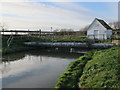
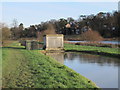
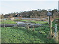
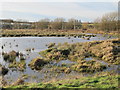
79 photos from this area
Area Information
Key information about the SG13 7HB including its size, population, and administrative classification.
- Area Type
- Postcode
- Area Size
- 1.3 hectares
- Population
- 2424
- Population Density
- 2193 people/km²
House Prices in SG13 7HB
42
Properties
£469,450
Average Sold Price
£230,000
Lowest Price
£680,000
Highest Price
Showing 42 properties
| Address | Type | Beds | Baths | Last Sale Price | Last Sale Date | |
|---|---|---|---|---|---|---|
| 214 Ware Road, Hertford, SG13 7HB | Semi-detached | 3 | 1 | £640,000 | Mar 2025 | |
| 218 Ware Road, Hertford, SG13 7HB | Semi-detached | 2 | 1 | £500,000 | May 2024 | |
| 186 Ware Road, Hertford, SG13 7HB | house | 4 | 2 | £540,000 | Feb 2024 | |
| 194 Ware Road, Hertford, SG13 7HB | Semi-detached | 4 | 2 | £635,000 | Mar 2023 | |
| 220 Ware Road, Hertford, SG13 7HB | Semi-detached | 3 | 2 | £575,000 | Mar 2022 | |
| 212 Ware Road, Hertford, SG13 7HB | Semi-detached | 2 | 2 | £680,000 | Sep 2021 | |
| 202 Ware Road, Hertford, SG13 7HB | house | 3 | - | £532,000 | Jan 2021 | |
| 178 Ware Road, Hertford, SG13 7HB | Semi-detached | 4 | 2 | £550,000 | Nov 2020 | |
| 224 Ware Road, Hertford, SG13 7HB | house | 4 | 2 | £537,000 | Nov 2020 | |
| 248 Ware Road, Hertford, SG13 7HB | Detached | 3 | 1 | £655,000 | Jul 2020 |
Page 1 of 5
Energy Efficiency in SG13 7HB
Amenities
Schools
| Rank | School | Type | Entry gender | Ages |
|---|
Explore more schools in this area
Go to Schools tabDemographics
Household Size
Family (3-5 people)
most common
Accommodation Type
Houses
most common
Tenure
73
majority
Ethnic Group
White
most common
Religion
N/A
most common
Household Composition
N/A
most common
Age
47
median
Adults (30-64 years)
most common
Household Deprivation
N/A
with no deprivation
NS-SEC
50
in Lower managerial occupations
Explore more demographic insights in this area
Go to Demographics tabPlanning
Planning Constraints
- Flood RiskPremium
- Ramsar Wetland SitesPremium
- Area of Outstanding Natural BeautyPremium
- Protected Nature ReservePremium
- Protected WoodlandPremium