Area Overview for SG13 7EJ
Photos of SG13 7EJ
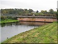
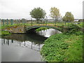
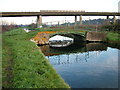
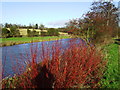
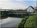
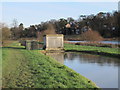
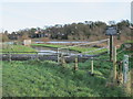
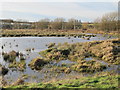
79 photos from this area
Area Information
Key information about the SG13 7EJ including its size, population, and administrative classification.
- Area Type
- Postcode
- Area Size
- 9196 m²
- Population
- 2424
- Population Density
- 2193 people/km²
House Prices in SG13 7EJ
22
Properties
£459,594
Average Sold Price
£98,500
Lowest Price
£763,000
Highest Price
Showing 22 properties
| Address | Type | Beds | Baths | Last Sale Price | Last Sale Date | |
|---|---|---|---|---|---|---|
| 237 Ware Road, Hertford, SG13 7EJ | Semi-detached | 3 | 1 | £650,000 | Feb 2025 | |
| 213 Ware Road, Hertford, SG13 7EJ | Semi-detached | - | - | £515,000 | Nov 2023 | |
| 209 Ware Road, Hertford, SG13 7EJ | Detached | 4 | 2 | £690,000 | Nov 2021 | |
| 223 Ware Road, Hertford, SG13 7EJ | house | - | - | £763,000 | Oct 2020 | |
| 233 Ware Road, Hertford, SG13 7EJ | house | - | - | £595,000 | Mar 2019 | |
| 253 Ware Road, Hertford, SG13 7EJ | house | - | - | £660,000 | Sep 2017 | |
| 235 Ware Road, Hertford, SG13 7EJ | Semi-detached | 3 | 1 | £550,000 | Aug 2016 | |
| 245 Ware Road, Hertford, SG13 7EJ | Semi-detached | 4 | 2 | £645,000 | May 2016 | |
| 215 Ware Road, Hertford, SG13 7EJ | house | - | - | £325,000 | Mar 2014 | |
| 219 Ware Road, Hertford, SG13 7EJ | house | - | - | £388,000 | Nov 2012 |
Page 1 of 3
Energy Efficiency in SG13 7EJ
Amenities
Schools
| Rank | School | Type | Entry gender | Ages |
|---|
Explore more schools in this area
Go to Schools tabDemographics
Household Size
Family (3-5 people)
most common
Accommodation Type
Houses
most common
Tenure
73
majority
Ethnic Group
White
most common
Religion
N/A
most common
Household Composition
N/A
most common
Age
47
median
Adults (30-64 years)
most common
Household Deprivation
N/A
with no deprivation
NS-SEC
50
in Lower managerial occupations
Explore more demographic insights in this area
Go to Demographics tabPlanning
Planning Constraints
- Flood RiskPremium
- Ramsar Wetland SitesPremium
- Area of Outstanding Natural BeautyPremium
- Protected Nature ReservePremium
- Protected WoodlandPremium