Area Overview for SG12 0BX
Photos of SG12 0BX


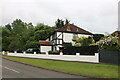
18 photos from this area
Area Information
Key information about the SG12 0BX including its size, population, and administrative classification.
- Area Type
- Postcode
- Area Size
- 5777 m²
- Population
- 1670
- Population Density
- 2823 people/km²
House Prices in SG12 0BX
48
Properties
£156,444
Average Sold Price
£36,500
Lowest Price
£260,000
Highest Price
Showing 48 properties
| Address | Type | Beds | Baths | Last Sale Price | Last Sale Date | |
|---|---|---|---|---|---|---|
| 196 Trapstyle Road, Ware, SG12 0BX | Flat | 2 | 1 | £195,000 | Sep 2025 | |
| 122 Trapstyle Road, Ware, SG12 0BX | Flat | 1 | - | £161,500 | Aug 2025 | |
| 170 Trapstyle Road, Ware, SG12 0BX | Flat | 2 | 1 | £239,995 | Jun 2025 | |
| 118 Trapstyle Road, Ware, SG12 0BX | Flat | 2 | 1 | £222,000 | Nov 2024 | |
| 132 Trapstyle Road, Ware, SG12 0BX | Flat | - | - | £240,000 | Jun 2024 | |
| 136 Trapstyle Road, Ware, SG12 0BX | Flat | - | - | £141,000 | May 2024 | |
| 120 Trapstyle Road, Ware, SG12 0BX | Flat | 1 | 1 | £171,000 | Jan 2024 | |
| 192 Trapstyle Road, Ware, SG12 0BX | Flat | 2 | 1 | £260,000 | Nov 2023 | |
| 116 Trapstyle Road, Ware, SG12 0BX | Flat | 2 | 1 | £227,500 | Nov 2023 | |
| 126 Trapstyle Road, Ware, SG12 0BX | Flat | 1 | 1 | £185,000 | May 2023 |
Page 1 of 5
Energy Efficiency in SG12 0BX
Amenities
Schools
| Rank | School | Type | Entry gender | Ages |
|---|
Explore more schools in this area
Go to Schools tabDemographics
Household Size
Two person
most common
Accommodation Type
Houses
most common
Tenure
80
majority
Ethnic Group
White
most common
Religion
N/A
most common
Household Composition
N/A
most common
Age
47
median
Adults (30-64 years)
most common
Household Deprivation
N/A
with no deprivation
NS-SEC
41
in Lower managerial occupations
Explore more demographic insights in this area
Go to Demographics tabPlanning
Planning Constraints
- Flood RiskPremium
- Ramsar Wetland SitesPremium
- Area of Outstanding Natural BeautyPremium
- Protected Nature ReservePremium
- Protected WoodlandPremium