Area Overview for SG12 0ER
Photos of SG12 0ER


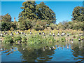
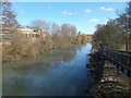
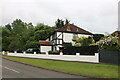
18 photos from this area
Area Information
Key information about the SG12 0ER including its size, population, and administrative classification.
- Area Type
- Postcode
- Area Size
- 3.6 hectares
- Population
- 1670
- Population Density
- 2823 people/km²
House Prices in SG12 0ER
82
Properties
£242,887
Average Sold Price
£74,995
Lowest Price
£424,000
Highest Price
Showing 82 properties
| Address | Type | Beds | Baths | Last Sale Price | Last Sale Date | |
|---|---|---|---|---|---|---|
| 43 The Hyde, Ware, SG12 0ER | Terraced | 3 | 1 | £424,000 | Sep 2025 | |
| 61 The Hyde, Ware, SG12 0ER | Flat | 1 | 1 | £217,000 | Jun 2025 | |
| 49 The Hyde, Ware, SG12 0ER | Terraced | 3 | 1 | £385,000 | Mar 2025 | |
| 55 The Hyde, Ware, SG12 0ER | Flat | 1 | 1 | £205,000 | Dec 2024 | |
| 16 The Hyde, Ware, SG12 0ER | Terraced | 3 | 1 | £415,000 | Oct 2024 | |
| 29 The Hyde, Ware, SG12 0ER | Terraced | 2 | 1 | £375,000 | Aug 2023 | |
| 71 The Hyde, Ware, SG12 0ER | Terraced | 2 | 1 | £375,000 | Apr 2023 | |
| 72 The Hyde, Ware, SG12 0ER | Terraced | 2 | 1 | £386,000 | Apr 2023 | |
| 50 The Hyde, Ware, SG12 0ER | Terraced | 3 | 1 | £415,500 | Feb 2023 | |
| 60 The Hyde, Ware, SG12 0ER | Flat | - | - | £210,000 | Feb 2023 |
Page 1 of 9
Energy Efficiency in SG12 0ER
Amenities
Schools
| Rank | School | Type | Entry gender | Ages |
|---|
Explore more schools in this area
Go to Schools tabDemographics
Household Size
Two person
most common
Accommodation Type
Houses
most common
Tenure
80
majority
Ethnic Group
White
most common
Religion
N/A
most common
Household Composition
N/A
most common
Age
47
median
Adults (30-64 years)
most common
Household Deprivation
N/A
with no deprivation
NS-SEC
41
in Lower managerial occupations
Explore more demographic insights in this area
Go to Demographics tabPlanning
Planning Constraints
- Flood RiskPremium
- Ramsar Wetland SitesPremium
- Area of Outstanding Natural BeautyPremium
- Protected Nature ReservePremium
- Protected WoodlandPremium