Area Overview for SG11 1QH
Photos of SG11 1QH
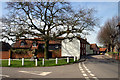
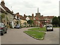
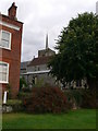
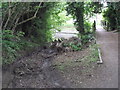
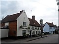
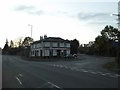
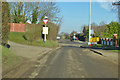
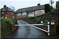
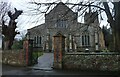
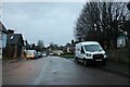
40 photos from this area
Area Information
Key information about the SG11 1QH including its size, population, and administrative classification.
- Area Type
- Postcode
- Area Size
- 1.0 hectares
- Population
- 1893
- Population Density
- 2538 people/km²
House Prices in SG11 1QH
25
Properties
£284,499
Average Sold Price
£100,000
Lowest Price
£465,000
Highest Price
Showing 25 properties
| Address | Type | Beds | Baths | Last Sale Price | Last Sale Date | |
|---|---|---|---|---|---|---|
| 24 Southfields, Standon, SG11 1QH | Semi-detached | - | - | £450,000 | Apr 2021 | |
| 15 Southfields, Standon, SG11 1QH | Semi-detached | 5 | - | £465,000 | Aug 2014 | |
| 19 Southfields, Standon, SG11 1QH | Semi-detached | 4 | - | £334,995 | Aug 2013 | |
| 14 Southfields, Standon, SG11 1QH | house | - | - | £250,000 | Sep 2009 | |
| 18 Southfields, Standon, SG11 1QH | Semi-detached | - | - | £319,000 | Nov 2007 | |
| 11 Southfields, Standon, SG11 1QH | house | 3 | - | £210,000 | Mar 2006 | |
| 12 Southfields, Standon, SG11 1QH | Semi-detached | - | - | £272,500 | Apr 2004 | |
| 21 Southfields, Standon, SG11 1QH | Semi-detached | - | - | £159,000 | May 2001 | |
| 20 Southfields, Standon, SG11 1QH | Semi-detached | - | - | £100,000 | Feb 2001 | |
| Annexe At, 23 Southfields, Standon, SG11 1QH | Detached | - | - | - | - |
Page 1 of 3
Energy Efficiency in SG11 1QH
Amenities
Schools
| Rank | School | Type | Entry gender | Ages |
|---|
Explore more schools in this area
Go to Schools tabDemographics
Household Size
Family (3-5 people)
most common
Accommodation Type
Houses
most common
Tenure
71
majority
Ethnic Group
White
most common
Religion
N/A
most common
Household Composition
N/A
most common
Age
47
median
Adults (30-64 years)
most common
Household Deprivation
N/A
with no deprivation
NS-SEC
35
in Lower managerial occupations
Explore more demographic insights in this area
Go to Demographics tabPlanning
Planning Constraints
- Flood RiskPremium
- Ramsar Wetland SitesPremium
- Area of Outstanding Natural BeautyPremium
- Protected Nature ReservePremium
- Protected WoodlandPremium