Area Overview for SG1 4NE
Photos of SG1 4NE

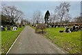
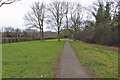
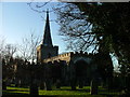
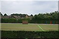
11 photos from this area
Area Information
Key information about the SG1 4NE including its size, population, and administrative classification.
- Area Type
- Postcode
- Area Size
- 7914 m²
- Population
- 1606
- Population Density
- 9209 people/km²
House Prices in SG1 4NE
31
Properties
£187,938
Average Sold Price
£34,000
Lowest Price
£335,000
Highest Price
Showing 31 properties
| Address | Type | Beds | Baths | Last Sale Price | Last Sale Date | |
|---|---|---|---|---|---|---|
| 196 Ripon Road, Stevenage, SG1 4NE | Flat | 1 | - | £150,000 | Aug 2024 | |
| 206 Ripon Road, Stevenage, SG1 4NE | Terraced | 3 | 1 | £335,000 | May 2024 | |
| 180 Ripon Road, Stevenage, SG1 4NE | house | 4 | 1 | £270,000 | Apr 2024 | |
| 152 Ripon Road, Stevenage, SG1 4NE | Flat | - | - | £196,500 | Mar 2023 | |
| 200 Ripon Road, Stevenage, SG1 4NE | Flat | - | - | £160,000 | Dec 2021 | |
| 176 Ripon Road, Stevenage, SG1 4NE | Terraced | 3 | 1 | £245,000 | Jul 2020 | |
| 168 Ripon Road, Stevenage, SG1 4NE | Terraced | 3 | 1 | £250,000 | May 2020 | |
| 156 Ripon Road, Stevenage, SG1 4NE | Flat | 1 | 1 | £134,000 | Aug 2019 | |
| 160 Ripon Road, Stevenage, SG1 4NE | Terraced | 3 | - | £260,000 | Sep 2018 | |
| 178 Ripon Road, Stevenage, SG1 4NE | house | - | - | £265,000 | Aug 2017 |
Page 1 of 4
Energy Efficiency in SG1 4NE
Amenities
Schools
| Rank | School | Type | Entry gender | Ages |
|---|
Explore more schools in this area
Go to Schools tabDemographics
Household Size
Family (3-5 people)
most common
Accommodation Type
Houses
most common
Tenure
56
majority
Ethnic Group
White
most common
Religion
N/A
most common
Household Composition
N/A
most common
Age
47
median
Adults (30-64 years)
most common
Household Deprivation
N/A
with no deprivation
NS-SEC
28
in Lower managerial occupations
Explore more demographic insights in this area
Go to Demographics tabPlanning
Planning Constraints
- Flood RiskPremium
- Ramsar Wetland SitesPremium
- Area of Outstanding Natural BeautyPremium
- Protected Nature ReservePremium
- Protected WoodlandPremium