Area Overview for SG1 4LT
Photos of SG1 4LT

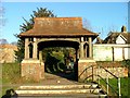
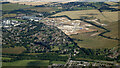
11 photos from this area
Area Information
Key information about the SG1 4LT including its size, population, and administrative classification.
- Area Type
- Postcode
- Area Size
- 7654 m²
- Population
- 1606
- Population Density
- 9209 people/km²
House Prices in SG1 4LT
24
Properties
£129,679
Average Sold Price
£1,483
Lowest Price
£260,000
Highest Price
Showing 24 properties
| Address | Type | Beds | Baths | Last Sale Price | Last Sale Date | |
|---|---|---|---|---|---|---|
| 329 Ripon Road, Stevenage, SG1 4LT | house | - | - | £260,000 | Jun 2019 | |
| 327 Ripon Road, Stevenage, SG1 4LT | Terraced | - | - | £1,483 | Mar 2017 | |
| 349 Ripon Road, Stevenage, SG1 4LT | Flat | - | - | £122,500 | Jul 2015 | |
| 321 Ripon Road, Stevenage, SG1 4LT | Terraced | 3 | 1 | £214,995 | Jan 2015 | |
| 325 Ripon Road, Stevenage, SG1 4LT | house | 3 | - | £162,500 | Mar 2013 | |
| 319 Ripon Road, Stevenage, SG1 4LT | Terraced | 3 | 1 | £167,000 | Sep 2008 | |
| 323 Ripon Road, Stevenage, SG1 4LT | Terraced | - | - | £152,000 | Apr 2005 | |
| 307 Ripon Road, Stevenage, SG1 4LT | Terraced | - | - | £133,000 | Jun 2003 | |
| 331 Ripon Road, Stevenage, SG1 4LT | Flat | - | - | £90,500 | Nov 2002 | |
| 353 Ripon Road, Stevenage, SG1 4LT | Terraced | - | - | £67,995 | Apr 1999 |
Page 1 of 3
Energy Efficiency in SG1 4LT
Amenities
Schools
| Rank | School | Type | Entry gender | Ages |
|---|
Explore more schools in this area
Go to Schools tabDemographics
Household Size
Family (3-5 people)
most common
Accommodation Type
Houses
most common
Tenure
56
majority
Ethnic Group
White
most common
Religion
N/A
most common
Household Composition
N/A
most common
Age
47
median
Adults (30-64 years)
most common
Household Deprivation
N/A
with no deprivation
NS-SEC
28
in Lower managerial occupations
Explore more demographic insights in this area
Go to Demographics tabPlanning
Planning Constraints
- Flood RiskPremium
- Ramsar Wetland SitesPremium
- Area of Outstanding Natural BeautyPremium
- Protected Nature ReservePremium
- Protected WoodlandPremium