Area Overview for SG1 4NB
Photos of SG1 4NB

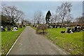
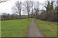
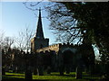
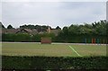
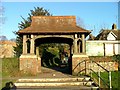
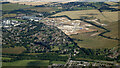
11 photos from this area
Area Information
Key information about the SG1 4NB including its size, population, and administrative classification.
- Area Type
- Postcode
- Area Size
- 7330 m²
- Population
- 1606
- Population Density
- 9209 people/km²
House Prices in SG1 4NB
31
Properties
£172,000
Average Sold Price
£87,000
Lowest Price
£290,000
Highest Price
Showing 31 properties
| Address | Type | Beds | Baths | Last Sale Price | Last Sale Date | |
|---|---|---|---|---|---|---|
| 76 Ripon Road, Stevenage, SG1 4NB | Terraced | 3 | 2 | £272,000 | Dec 2020 | |
| 74 Ripon Road, Stevenage, SG1 4NB | house | - | - | £290,000 | Oct 2020 | |
| 78 Ripon Road, Stevenage, SG1 4NB | Terraced | 3 | 1 | £240,000 | Apr 2018 | |
| 86 Ripon Road, Stevenage, SG1 4NB | house | - | - | £229,000 | Feb 2016 | |
| 106 Ripon Road, Stevenage, SG1 4NB | Flat | - | - | £87,000 | Jun 2013 | |
| 116 Ripon Road, Stevenage, SG1 4NB | Flat | - | - | £110,000 | Aug 2011 | |
| 66 Ripon Road, Stevenage, SG1 4NB | house | 3 | 1 | £149,000 | Mar 2006 | |
| 64 Ripon Road, Stevenage, SG1 4NB | house | - | - | £126,995 | Feb 2003 | |
| 68 Ripon Road, Stevenage, SG1 4NB | house | - | - | £119,000 | Jul 2002 | |
| 92 Ripon Road, Stevenage, SG1 4NB | house | - | - | £97,000 | Oct 2001 |
Page 1 of 4
Energy Efficiency in SG1 4NB
Amenities
Schools
| Rank | School | Type | Entry gender | Ages |
|---|
Explore more schools in this area
Go to Schools tabDemographics
Household Size
Family (3-5 people)
most common
Accommodation Type
Houses
most common
Tenure
56
majority
Ethnic Group
White
most common
Religion
N/A
most common
Household Composition
N/A
most common
Age
47
median
Adults (30-64 years)
most common
Household Deprivation
N/A
with no deprivation
NS-SEC
28
in Lower managerial occupations
Explore more demographic insights in this area
Go to Demographics tabPlanning
Planning Constraints
- Flood RiskPremium
- Ramsar Wetland SitesPremium
- Area of Outstanding Natural BeautyPremium
- Protected Nature ReservePremium
- Protected WoodlandPremium