Area Overview for SG1 4LR
Photos of SG1 4LR

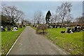
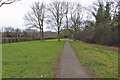
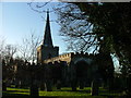
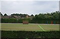
11 photos from this area
Area Information
Key information about the SG1 4LR including its size, population, and administrative classification.
- Area Type
- Postcode
- Area Size
- 2.0 hectares
- Population
- 1606
- Population Density
- 9209 people/km²
House Prices in SG1 4LR
48
Properties
£174,683
Average Sold Price
£45,000
Lowest Price
£325,000
Highest Price
Showing 48 properties
| Address | Type | Beds | Baths | Last Sale Price | Last Sale Date | |
|---|---|---|---|---|---|---|
| 233 Ripon Road, Stevenage, SG1 4LR | Terraced | 3 | 1 | £320,000 | Jul 2025 | |
| 249 Ripon Road, Stevenage, SG1 4LR | Terraced | 3 | 1 | £325,000 | Mar 2025 | |
| 181 Ripon Road, Stevenage, SG1 4LR | house | - | - | £295,000 | Feb 2022 | |
| 191 Ripon Road, Stevenage, SG1 4LR | Bungalow | - | - | £315,000 | Dec 2021 | |
| 195 Ripon Road, Stevenage, SG1 4LR | Terraced | 4 | 1 | £275,000 | Jul 2020 | |
| 213 Ripon Road, Stevenage, SG1 4LR | Terraced | 3 | - | £275,000 | Sep 2019 | |
| 215 Ripon Road, Stevenage, SG1 4LR | Terraced | 3 | 1 | £270,000 | Jul 2017 | |
| 231 Ripon Road, Stevenage, SG1 4LR | Terraced | 3 | - | £245,000 | Jan 2016 | |
| 257 Ripon Road, Stevenage, SG1 4LR | house | - | - | £218,000 | Jan 2015 | |
| 177 Ripon Road, Stevenage, SG1 4LR | Terraced | 4 | 2 | £170,000 | Sep 2013 |
Page 1 of 5
Energy Efficiency in SG1 4LR
Amenities
Schools
| Rank | School | Type | Entry gender | Ages |
|---|
Explore more schools in this area
Go to Schools tabDemographics
Household Size
Family (3-5 people)
most common
Accommodation Type
Houses
most common
Tenure
56
majority
Ethnic Group
White
most common
Religion
N/A
most common
Household Composition
N/A
most common
Age
47
median
Adults (30-64 years)
most common
Household Deprivation
N/A
with no deprivation
NS-SEC
28
in Lower managerial occupations
Explore more demographic insights in this area
Go to Demographics tabPlanning
Planning Constraints
- Flood RiskPremium
- Ramsar Wetland SitesPremium
- Area of Outstanding Natural BeautyPremium
- Protected Nature ReservePremium
- Protected WoodlandPremium