Area Overview for SG1 4ER
Photos of SG1 4ER

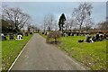
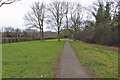
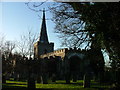
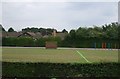
11 photos from this area
Area Information
Key information about the SG1 4ER including its size, population, and administrative classification.
- Area Type
- Postcode
- Area Size
- 1392 m²
- Population
- 1477
- Population Density
- 6573 people/km²
House Prices in SG1 4ER
6
Properties
£90,000
Average Sold Price
£40,000
Lowest Price
£145,000
Highest Price
Showing 6 properties
| Address | Type | Beds | Baths | Last Sale Price | Last Sale Date | |
|---|---|---|---|---|---|---|
| 536 York Road, Stevenage, SG1 4ER | Terraced | - | - | £145,000 | Mar 2005 | |
| 528 York Road, Stevenage, SG1 4ER | Terraced | - | - | £40,000 | Oct 2000 | |
| 534 York Road, Stevenage, SG1 4ER | Terraced | - | - | £77,000 | Jul 2000 | |
| 538 York Road, Stevenage, SG1 4ER | Terraced | 5 | 1 | £98,000 | Mar 2000 | |
| 530 York Road, Stevenage, SG1 4ER | Terraced | - | - | - | - | |
| 532 York Road, Stevenage, SG1 4ER | Terraced | - | - | - | - |
Energy Efficiency in SG1 4ER
Amenities
Schools
| Rank | School | Type | Entry gender | Ages |
|---|
Explore more schools in this area
Go to Schools tabDemographics
Household Size
Family (3-5 people)
most common
Accommodation Type
Houses
most common
Tenure
66
majority
Ethnic Group
White
most common
Religion
N/A
most common
Household Composition
N/A
most common
Age
47
median
Adults (30-64 years)
most common
Household Deprivation
N/A
with no deprivation
NS-SEC
31
in Lower managerial occupations
Explore more demographic insights in this area
Go to Demographics tabPlanning
Planning Constraints
- Flood RiskPremium
- Ramsar Wetland SitesPremium
- Area of Outstanding Natural BeautyPremium
- Protected Nature ReservePremium
- Protected WoodlandPremium