Area Overview for SG1 4JS
Photos of SG1 4JS


Area Information
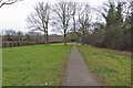
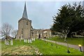
Living in SG1 4JS means residing within a specific postcode area that covers a small residential cluster. This compact settlement sits within the broader Stevenage landscape in England. The total population stands at 1,477 residents, creating a close-knit environment where neighbours often know each other by name. Daily life here revolves around a quiet, established residential feel rather than the pace of a major urban centre. You will find a community defined by stability and long-term residency rather than transient populations. The area functions as a practical home for families and individuals seeking a manageable living space. The character of SG1 4JS is shaped significantly by its housing stock and the demographics that inhabit it. With homes predominantly taking the form of detached or semi-detached structures, the visual landscape is consistent and traditional. There are no large estate developments or high-rise blocks to disrupt the sense of place. Instead, the streets feature properties that reflect a settled history within the Stevenage region. Residents benefit from a location that balances accessibility with the peace of a smaller residential zone. Whether you are commuting from here or enjoying the local amenities, the scale of SG1 4JS ensures a lived-in feel that avoids anonymity. It is a place where specific, tangible facts about the area define your everyday experience.
- Area Type
- Postcode
- Area Size
- Not available
- Population
- 1477
- Population Density
- 6573 people/km²
The property market in SG1 4JS is overwhelmingly defined by owner-occupation. With 66% of households owning their homes, this area functions as a traditional residential market rather than a high-turnover rental district. The vast majority of accommodations are houses, suggesting a landscape of bungalows, detached homes, or semi-detached properties. You will rarely encounter purpose-built flats or apartment developments within this small postcode area. This housing stock caters to families and individuals who prioritise space and independence over the density of city living. For buyers looking at SG1 4JS, the market offers established stock rather than new-build complexes. The predominance of houses means that energy efficiency, garden space, and driveway access are key competitive factors. The high ownership percentage often implies that properties have been cared for over many years, potentially offering better quality of construction compared to speculative builds in other regions. However, the limited size of the cluster means choice is finite; there are fewer listings to select from compared to larger towns. If you are buying in SG1 4JS, you are entering a market where prices reflect local demand for family-sized homes rather than student rentals or transient tenancies.
House Prices in SG1 4JS
No properties found in this postcode.
Energy Efficiency in SG1 4JS
The lifestyle available to residents of SG1 4JS revolves around key amenities located within practical reach of every home. For your daily shopping needs, you have access to five retail venues. Morrisons Daily appears twice in the list of nearest shops, providing reliable grocery options. Co-op Stevenage also serves the area, ensuring you do not need to travel far for general provisions or household essentials. These local supermarkets form the retail backbone of the neighbourhood, making supermarket runs a short drive or walk depending on your specific property location. Transport connectivity further enhances your lifestyle by linking you to broader regional opportunities. Five railway stations are accessible, including Stevenage, Knebworth, and Hitchin. This means you can catch a train without needing to travel through the main town centre for a quick journey. The proximity of these stations allows for flexibility in your commute or leisure trips. While the immediate area focuses on residential housing, the reach of Stevenage and Knebworth stations means you are close to retail parks, cinemas, and leisure centres not explicitly listed in SG1 4JS but easily reachable. Living in SG1 4JS grants you the convenience of local hypermarkets alongside the connectivity of regional transport hubs.
Amenities
Schools
Families living in SG1 4JS have two primary schools within their immediate catchment or vicinity. The Giles Infant and Nursery School serves the younger pupils in the area. This infant school holds a good Ofsted rating, indicating a standard of education that meets national expectations. For children progressing to secondary age, the nearest option is Giles Junior School. This school also carries a good Ofsted rating, providing continuity of quality as children move from infant to junior stages. This mix of primary education facilities means that families with young children need to look further afield for secondary school options, as the data only confirms primary provision rated good. The presence of two schools with good ratings offers reassurance to parents regarding the educational foundation available locally. While there are no secondary schools listed in the immediate data, the strong performance of the infant and junior centres suggests a family-friendly environment. Whether you are buying a home in SG1 4JS for a child starting school or a family awaiting a move, these institutions provide a solid start to the academic journey.
| Rank | School | Type | Entry gender | Ages |
|---|
Explore more schools in this area
Go to Schools tabDemographics
The community in SG1 4JS reflects a mature population with a median age of 47 years. Most residents fall into the adult age range between 30 and 64 years, which suggests a neighbourhood stable enough for families and professionals alike. This age profile indicates that the area attracts those who have moved beyond their early twenties and settled permanently. The demographic structure points toward a quiet life away from the noise of student housing or young transient demographics. Home ownership is a dominant feature of this neighbourhood, with 66% of residents owning their property outright or with a mortgage. This high rate signifies long-term investment in the local community and a lower churn rate compared to rental-heavy areas. The remaining residents likely rent, but the overall ownership figure drives a desire for permanence and stability. Accommodation types are primarily houses, reinforcing the family-oriented nature of the cluster. Predominantly White ethnicity forms the settled cultural backdrop of the area, contributing to a cohesive community dynamic. These statistics paint a picture of a place where people grow old, raise children, and maintain their homes over decades.
Household Size
Accommodation Type
Tenure
Ethnic Group
Religion
Household Composition
Age
Household Deprivation
NS-SEC
Explore more demographic insights in this area
Go to Demographics tabPlanning
Planning Constraints
- Flood RiskPremium
- Ramsar Wetland SitesPremium
- Area of Outstanding Natural BeautyPremium
- Protected Nature ReservePremium
- Protected WoodlandPremium