Area Overview for SG1 3NL
Photos of SG1 3NL
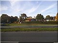
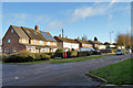
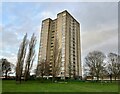
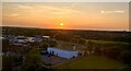
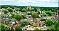
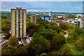

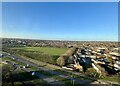
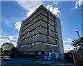
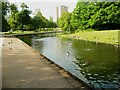
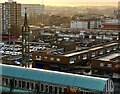
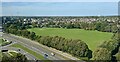
39 photos from this area
Area Information
Key information about the SG1 3NL including its size, population, and administrative classification.
- Area Type
- Postcode
- Area Size
- 1.4 hectares
- Population
- 2302
- Population Density
- 4934 people/km²
House Prices in SG1 3NL
28
Properties
£295,929
Average Sold Price
£147,500
Lowest Price
£505,000
Highest Price
Showing 28 properties
| Address | Type | Beds | Baths | Last Sale Price | Last Sale Date | |
|---|---|---|---|---|---|---|
| 11A Greydells Road, Stevenage, SG1 3NL | Maisonette | 2 | 1 | £204,000 | Oct 2025 | |
| 17 Greydells Road, Stevenage, SG1 3NL | Detached | 3 | 1 | £335,000 | Jul 2025 | |
| 6 Greydells Road, Stevenage, SG1 3NL | Terraced | 2 | 1 | £376,000 | May 2022 | |
| 16 Greydells Road, Stevenage, SG1 3NL | house | - | - | £505,000 | Apr 2021 | |
| 27 Greydells Road, Stevenage, SG1 3NL | house | - | - | £325,000 | Oct 2020 | |
| 3 Greydells Road, Stevenage, SG1 3NL | house | 3 | 1 | £375,000 | Feb 2020 | |
| 14 Greydells Road, Stevenage, SG1 3NL | Terraced | 3 | 1 | £337,500 | Dec 2019 | |
| 15 Greydells Road, Stevenage, SG1 3NL | house | - | - | £312,500 | Nov 2019 | |
| 2A Greydells Road, Stevenage, SG1 3NL | house | - | - | £270,000 | Jan 2019 | |
| 21 Greydells Road, Stevenage, SG1 3NL | Semi-detached | 3 | - | £336,000 | Jul 2018 |
Page 1 of 3
Energy Efficiency in SG1 3NL
Amenities
Schools
| Rank | School | Type | Entry gender | Ages |
|---|
Explore more schools in this area
Go to Schools tabDemographics
Household Size
One person
most common
Accommodation Type
Flats
most common
Tenure
42
majority
Ethnic Group
White
most common
Religion
N/A
most common
Household Composition
N/A
most common
Age
47
median
Adults (30-64 years)
most common
Household Deprivation
N/A
with no deprivation
NS-SEC
37
in Lower managerial occupations
Explore more demographic insights in this area
Go to Demographics tabPlanning
Planning Constraints
- Flood RiskPremium
- Ramsar Wetland SitesPremium
- Area of Outstanding Natural BeautyPremium
- Protected Nature ReservePremium
- Protected WoodlandPremium