Area Overview for SG1 2LW
Photos of SG1 2LW
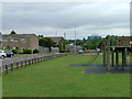
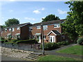
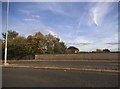
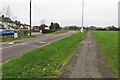
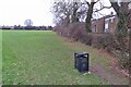
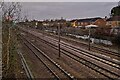
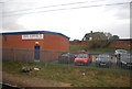

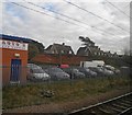
19 photos from this area
Area Information
Key information about the SG1 2LW including its size, population, and administrative classification.
- Area Type
- Postcode
- Area Size
- 1.1 hectares
- Population
- 1531
- Population Density
- 6262 people/km²
House Prices in SG1 2LW
64
Properties
£140,749
Average Sold Price
£34,720
Lowest Price
£355,000
Highest Price
Showing 64 properties
| Address | Type | Beds | Baths | Last Sale Price | Last Sale Date | |
|---|---|---|---|---|---|---|
| 116 Yarmouth Road, Stevenage, SG1 2LW | Detached | 3 | 1 | £355,000 | Jan 2025 | |
| 104 Yarmouth Road, Stevenage, SG1 2LW | Flat | - | - | £210,000 | Sep 2022 | |
| 10 Yarmouth Road, Stevenage, SG1 2LW | Flat | - | - | £155,000 | Mar 2022 | |
| 8 Yarmouth Road, Stevenage, SG1 2LW | Flat | 2 | 1 | £206,500 | Dec 2021 | |
| 86 Yarmouth Road, Stevenage, SG1 2LW | Flat | - | - | £232,000 | May 2021 | |
| 108 Yarmouth Road, Stevenage, SG1 2LW | Flat | - | - | £132,500 | Jul 2020 | |
| 102 Yarmouth Road, Stevenage, SG1 2LW | Flat | - | - | £135,000 | Dec 2019 | |
| 118 Yarmouth Road, Stevenage, SG1 2LW | house | - | - | £262,000 | Jun 2019 | |
| 82 Yarmouth Road, Stevenage, SG1 2LW | Flat | - | - | £158,500 | Sep 2018 | |
| 34 Yarmouth Road, Stevenage, SG1 2LW | Flat | - | - | £173,000 | Jan 2018 |
Page 1 of 7
Energy Efficiency in SG1 2LW
Amenities
Schools
| Rank | School | Type | Entry gender | Ages |
|---|
Explore more schools in this area
Go to Schools tabDemographics
Household Size
One person
most common
Accommodation Type
Houses
most common
Tenure
36
majority
Ethnic Group
White
most common
Religion
N/A
most common
Household Composition
N/A
most common
Age
47
median
Adults (30-64 years)
most common
Household Deprivation
N/A
with no deprivation
NS-SEC
27
in Lower managerial occupations
Explore more demographic insights in this area
Go to Demographics tabPlanning
Planning Constraints
- Flood RiskPremium
- Ramsar Wetland SitesPremium
- Area of Outstanding Natural BeautyPremium
- Protected Nature ReservePremium
- Protected WoodlandPremium