Area Overview for SG1 2LS
Photos of SG1 2LS
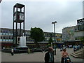
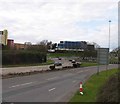

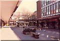
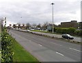
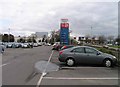

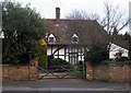

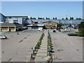
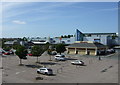
100 photos from this area
Area Information
Key information about the SG1 2LS including its size, population, and administrative classification.
- Area Type
- Postcode
- Area Size
- 2.0 hectares
- Population
- 2680
- Population Density
- 4255 people/km²
House Prices in SG1 2LS
74
Properties
£100,184
Average Sold Price
£54,250
Lowest Price
£225,000
Highest Price
Showing 74 properties
| Address | Type | Beds | Baths | Last Sale Price | Last Sale Date | |
|---|---|---|---|---|---|---|
| 33 Watson Road, Stevenage, SG1 2LS | Flat | - | - | £99,000 | Nov 2023 | |
| 38 Watson Road, Stevenage, SG1 2LS | Flat | 2 | 1 | £143,000 | Feb 2023 | |
| 37 Watson Road, Stevenage, SG1 2LS | Flat | 1 | 1 | £66,500 | Feb 2021 | |
| 27 Watson Road, Stevenage, SG1 2LS | Flat | 2 | - | £78,750 | Jul 2019 | |
| 13 Watson Road, Stevenage, SG1 2LS | Flat | - | - | £225,000 | Jul 2018 | |
| 32 Watson Road, Stevenage, SG1 2LS | Flat | - | - | £112,500 | Jul 2018 | |
| 30 Watson Road, Stevenage, SG1 2LS | Flat | - | - | £123,750 | Jul 2018 | |
| 28 Watson Road, Stevenage, SG1 2LS | Flat | - | - | £90,000 | May 2018 | |
| 31 Watson Road, Stevenage, SG1 2LS | Flat | - | - | £100,000 | Sep 2017 | |
| 10 Watson Road, Stevenage, SG1 2LS | Flat | - | - | £85,000 | Jun 2015 |
Page 1 of 8
Energy Efficiency in SG1 2LS
Amenities
Schools
| Rank | School | Type | Entry gender | Ages |
|---|
Explore more schools in this area
Go to Schools tabDemographics
Household Size
Two person
most common
Accommodation Type
Houses
most common
Tenure
61
majority
Ethnic Group
White
most common
Religion
N/A
most common
Household Composition
N/A
most common
Age
47
median
Adults (30-64 years)
most common
Household Deprivation
N/A
with no deprivation
NS-SEC
45
in Lower managerial occupations
Explore more demographic insights in this area
Go to Demographics tabPlanning
Planning Constraints
- Flood RiskPremium
- Ramsar Wetland SitesPremium
- Area of Outstanding Natural BeautyPremium
- Protected Nature ReservePremium
- Protected WoodlandPremium