Area Overview for SG1 2NE
Photos of SG1 2NE
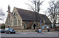
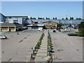
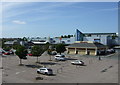
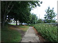
100 photos from this area
Area Information
Key information about the SG1 2NE including its size, population, and administrative classification.
- Area Type
- Postcode
- Area Size
- 1.7 hectares
- Population
- 2680
- Population Density
- 4255 people/km²
House Prices in SG1 2NE
30
Properties
£506,366
Average Sold Price
£150,000
Lowest Price
£920,000
Highest Price
Showing 30 properties
| Address | Type | Beds | Baths | Last Sale Price | Last Sale Date | |
|---|---|---|---|---|---|---|
| 165 Fairview Road, Stevenage, SG1 2NE | Semi-detached | 4 | 2 | £637,000 | Sep 2024 | |
| 176 Fairview Road, Stevenage, SG1 2NE | Detached | 4 | 3 | £772,500 | Aug 2024 | |
| 173 Fairview Road, Stevenage, SG1 2NE | Detached | 3 | 2 | £555,000 | Sep 2023 | |
| 164 Fairview Road, Stevenage, SG1 2NE | house | - | - | £625,000 | Jan 2022 | |
| 154 Fairview Road, Stevenage, SG1 2NE | Detached | 5 | 2 | £667,500 | Sep 2020 | |
| 168 Fairview Road, Stevenage, SG1 2NE | Detached | 4 | 1 | £570,000 | Feb 2020 | |
| 149 Fairview Road, Stevenage, SG1 2NE | Maisonette | 2 | 1 | £680,000 | Apr 2019 | |
| 158 Fairview Road, Stevenage, SG1 2NE | house | - | - | £489,995 | Jan 2016 | |
| 162 Fairview Road, Stevenage, SG1 2NE | Semi-detached | 4 | 2 | £400,000 | Jan 2014 | |
| 166 Fairview Road, Stevenage, SG1 2NE | Detached | 4 | 2 | £325,000 | Oct 2011 |
Page 1 of 3
Energy Efficiency in SG1 2NE
Amenities
Schools
| Rank | School | Type | Entry gender | Ages |
|---|
Explore more schools in this area
Go to Schools tabDemographics
Household Size
Two person
most common
Accommodation Type
Houses
most common
Tenure
61
majority
Ethnic Group
White
most common
Religion
N/A
most common
Household Composition
N/A
most common
Age
47
median
Adults (30-64 years)
most common
Household Deprivation
N/A
with no deprivation
NS-SEC
45
in Lower managerial occupations
Explore more demographic insights in this area
Go to Demographics tabPlanning
Planning Constraints
- Flood RiskPremium
- Ramsar Wetland SitesPremium
- Area of Outstanding Natural BeautyPremium
- Protected Nature ReservePremium
- Protected WoodlandPremium