Area Overview for SG1 2JS
Photos of SG1 2JS
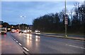
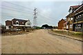
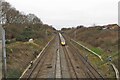
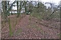

27 photos from this area
Area Information
Key information about the SG1 2JS including its size, population, and administrative classification.
- Area Type
- Postcode
- Area Size
- 1.5 hectares
- Population
- 1662
- Population Density
- 3034 people/km²
House Prices in SG1 2JS
23
Properties
£314,176
Average Sold Price
£96,000
Lowest Price
£625,000
Highest Price
Showing 23 properties
| Address | Type | Beds | Baths | Last Sale Price | Last Sale Date | |
|---|---|---|---|---|---|---|
| 13 Gorleston Close, Stevenage, SG1 2JS | Semi-detached | 3 | 2 | £435,000 | Oct 2024 | |
| 1 Gorleston Close, Stevenage, SG1 2JS | house | 3 | 2 | £550,000 | Apr 2024 | |
| 15 Gorleston Close, Stevenage, SG1 2JS | house | - | - | £625,000 | Feb 2023 | |
| 14 Gorleston Close, Stevenage, SG1 2JS | house | - | - | £567,500 | Dec 2022 | |
| 9 Gorleston Close, Stevenage, SG1 2JS | house | - | - | £415,000 | Jun 2021 | |
| 2 Gorleston Close, Stevenage, SG1 2JS | house | - | - | £460,000 | Jun 2021 | |
| 11 Gorleston Close, Stevenage, SG1 2JS | house | - | - | £355,000 | Mar 2020 | |
| 10 Gorleston Close, Stevenage, SG1 2JS | Semi-detached | 3 | 2 | £290,000 | Jul 2015 | |
| 3 Gorleston Close, Stevenage, SG1 2JS | Detached | 4 | 1 | £270,000 | Nov 2013 | |
| 19 Gorleston Close, Stevenage, SG1 2JS | Semi-detached | - | - | £249,000 | Nov 2007 |
Page 1 of 3
Energy Efficiency in SG1 2JS
Amenities
Schools
| Rank | School | Type | Entry gender | Ages |
|---|
Explore more schools in this area
Go to Schools tabDemographics
Household Size
Two person
most common
Accommodation Type
Houses
most common
Tenure
60
majority
Ethnic Group
White
most common
Religion
N/A
most common
Household Composition
N/A
most common
Age
47
median
Adults (30-64 years)
most common
Household Deprivation
N/A
with no deprivation
NS-SEC
37
in Lower managerial occupations
Explore more demographic insights in this area
Go to Demographics tabPlanning
Planning Constraints
- Flood RiskPremium
- Ramsar Wetland SitesPremium
- Area of Outstanding Natural BeautyPremium
- Protected Nature ReservePremium
- Protected WoodlandPremium