Area Overview for SG1 4RJ
Photos of SG1 4RJ
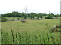
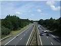
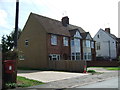
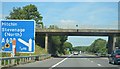
27 photos from this area
Area Information
Key information about the SG1 4RJ including its size, population, and administrative classification.
- Area Type
- Postcode
- Area Size
- 3.2 hectares
- Population
- 2178
- Population Density
- 1286 people/km²
House Prices in SG1 4RJ
61
Properties
£240,275
Average Sold Price
£39,000
Lowest Price
£475,000
Highest Price
Showing 61 properties
| Address | Type | Beds | Baths | Last Sale Price | Last Sale Date | |
|---|---|---|---|---|---|---|
| 61 Chapman Road, Stevenage, SG1 4RJ | Detached | 2 | - | £350,000 | Jul 2025 | |
| 29 Chapman Road, Stevenage, SG1 4RJ | Maisonette | 1 | 1 | £210,000 | Jul 2025 | |
| 10 Chapman Road, Stevenage, SG1 4RJ | house | 2 | 1 | £370,000 | Mar 2025 | |
| 87 Chapman Road, Stevenage, SG1 4RJ | Terraced | 2 | 1 | £335,000 | Mar 2025 | |
| 63 Chapman Road, Stevenage, SG1 4RJ | house | - | - | £350,000 | Dec 2024 | |
| 21 Chapman Road, Stevenage, SG1 4RJ | Terraced | 2 | 1 | £312,500 | Nov 2024 | |
| 53 Chapman Road, Stevenage, SG1 4RJ | house | - | - | £192,362 | Jul 2024 | |
| 20 Chapman Road, Stevenage, SG1 4RJ | house | - | - | £466,000 | Mar 2024 | |
| 1 Chapman Road, Stevenage, SG1 4RJ | house | - | - | £390,000 | Feb 2023 | |
| 14 Chapman Road, Stevenage, SG1 4RJ | house | - | - | £450,000 | Dec 2022 |
Page 1 of 7
Energy Efficiency in SG1 4RJ
Amenities
Schools
| Rank | School | Type | Entry gender | Ages |
|---|
Explore more schools in this area
Go to Schools tabDemographics
Household Size
Two person
most common
Accommodation Type
Houses
most common
Tenure
57
majority
Ethnic Group
White
most common
Religion
N/A
most common
Household Composition
N/A
most common
Age
47
median
Adults (30-64 years)
most common
Household Deprivation
N/A
with no deprivation
NS-SEC
47
in Lower managerial occupations
Explore more demographic insights in this area
Go to Demographics tabPlanning
Planning Constraints
- Flood RiskPremium
- Ramsar Wetland SitesPremium
- Area of Outstanding Natural BeautyPremium
- Protected Nature ReservePremium
- Protected WoodlandPremium