Area Overview for RM16 2QL
Photos of RM16 2QL
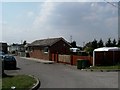
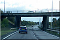
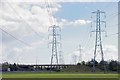
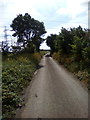

15 photos from this area
Area Information
Key information about the RM16 2QL including its size, population, and administrative classification.
- Area Type
- Postcode
- Area Size
- 5.1 hectares
- Population
- 1211
- Population Density
- 3175 people/km²
House Prices in RM16 2QL
39
Properties
£235,983
Average Sold Price
£31,888
Lowest Price
£390,000
Highest Price
Showing 39 properties
| Address | Type | Beds | Baths | Last Sale Price | Last Sale Date | |
|---|---|---|---|---|---|---|
| 23 Milford Road, Grays, RM16 2QL | Terraced | 3 | - | £326,000 | Jun 2025 | |
| 20 Milford Road, Grays, RM16 2QL | Terraced | 3 | 1 | £365,000 | May 2025 | |
| 13 Milford Road, Grays, RM16 2QL | Terraced | 3 | 1 | £335,500 | Jan 2025 | |
| 25 Milford Road, Grays, RM16 2QL | Terraced | 3 | 2 | £390,000 | Dec 2024 | |
| 43 Milford Road, Grays, RM16 2QL | Terraced | 3 | 1 | £375,000 | Sep 2023 | |
| 6 Milford Road, Grays, RM16 2QL | Terraced | 3 | 1 | £365,000 | Oct 2022 | |
| 37 Milford Road, Grays, RM16 2QL | house | 3 | - | £330,000 | Oct 2022 | |
| 11 Milford Road, Grays, RM16 2QL | house | 4 | 2 | £335,000 | Dec 2021 | |
| 27 Milford Road, Grays, RM16 2QL | Terraced | 3 | 1 | £270,000 | Jun 2020 | |
| 14 Milford Road, Grays, RM16 2QL | house | 3 | 1 | £255,000 | Jan 2020 |
Page 1 of 4
Energy Efficiency in RM16 2QL
Amenities
Schools
| Rank | School | Type | Entry gender | Ages |
|---|
Explore more schools in this area
Go to Schools tabDemographics
Household Size
Family (3-5 people)
most common
Accommodation Type
Houses
most common
Tenure
45
majority
Ethnic Group
White
most common
Religion
N/A
most common
Household Composition
N/A
most common
Age
47
median
Adults (30-64 years)
most common
Household Deprivation
N/A
with no deprivation
NS-SEC
21
in Lower managerial occupations
Explore more demographic insights in this area
Go to Demographics tabPlanning
Planning Constraints
- Flood RiskPremium
- Ramsar Wetland SitesPremium
- Area of Outstanding Natural BeautyPremium
- Protected Nature ReservePremium
- Protected WoodlandPremium