Area Overview for RM16 2QH
Photos of RM16 2QH
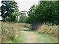

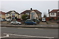
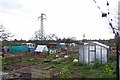
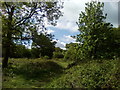


46 photos from this area
Area Information
Key information about the RM16 2QH including its size, population, and administrative classification.
- Area Type
- Postcode
- Area Size
- 26.9 hectares
- Population
- 1211
- Population Density
- 3175 people/km²
House Prices in RM16 2QH
21
Properties
£254,835
Average Sold Price
£70,196
Lowest Price
£445,000
Highest Price
Showing 21 properties
| Address | Type | Beds | Baths | Last Sale Price | Last Sale Date | |
|---|---|---|---|---|---|---|
| 320 Long Lane, Stifford Clays, Grays, RM16 2QH | Semi-detached | 3 | 1 | £440,000 | Feb 2022 | |
| 316 Long Lane, Stifford Clays, Grays, RM16 2QH | Semi-detached | 5 | 3 | £445,000 | Apr 2021 | |
| 314 Long Lane, Stifford Clays, Grays, RM16 2QH | Detached | 4 | 1 | £431,000 | Jul 2019 | |
| 326 Long Lane, Stifford Clays, Grays, RM16 2QH | Semi-detached | 4 | - | £280,000 | Jun 2014 | |
| 330 Long Lane, Stifford Clays, Grays, RM16 2QH | Semi-detached | - | - | £249,995 | Sep 2007 | |
| 318 Long Lane, Stifford Clays, Grays, RM16 2QH | Semi-detached | - | - | £229,995 | May 2007 | |
| 324 Long Lane, Stifford Clays, Grays, RM16 2QH | Semi-detached | - | - | £205,000 | Jul 2005 | |
| 328 Long Lane, Stifford Clays, Grays, RM16 2QH | Semi-detached | - | - | £178,500 | Jun 2004 | |
| 332 Long Lane, Stifford Clays, Grays, RM16 2QH | Semi-detached | - | - | £120,000 | Oct 2003 | |
| 311 Long Lane, Stifford Clays, Grays, RM16 2QH | Semi-detached | - | - | £153,500 | Jul 2002 |
Page 1 of 3
Energy Efficiency in RM16 2QH
Amenities
Schools
| Rank | School | Type | Entry gender | Ages |
|---|
Explore more schools in this area
Go to Schools tabDemographics
Household Size
Family (3-5 people)
most common
Accommodation Type
Houses
most common
Tenure
45
majority
Ethnic Group
White
most common
Religion
N/A
most common
Household Composition
N/A
most common
Age
47
median
Adults (30-64 years)
most common
Household Deprivation
N/A
with no deprivation
NS-SEC
21
in Lower managerial occupations
Explore more demographic insights in this area
Go to Demographics tabPlanning
Planning Constraints
- Flood RiskPremium
- Ramsar Wetland SitesPremium
- Area of Outstanding Natural BeautyPremium
- Protected Nature ReservePremium
- Protected WoodlandPremium