Area Overview for RM15 6AX
Photos of RM15 6AX
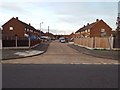
28 photos from this area
Area Information
Key information about the RM15 6AX including its size, population, and administrative classification.
- Area Type
- Postcode
- Area Size
- 1.2 hectares
- Population
- 1915
- Population Density
- 6832 people/km²
House Prices in RM15 6AX
28
Properties
£204,152
Average Sold Price
£38,748
Lowest Price
£327,000
Highest Price
Showing 28 properties
| Address | Type | Beds | Baths | Last Sale Price | Last Sale Date | |
|---|---|---|---|---|---|---|
| 39 Cherwell Grove, South Ockendon, RM15 6AX | Terraced | 3 | 1 | £315,000 | Nov 2024 | |
| 47 Cherwell Grove, South Ockendon, RM15 6AX | Terraced | 3 | 1 | £300,000 | Jun 2024 | |
| 63 Cherwell Grove, South Ockendon, RM15 6AX | Terraced | 3 | 1 | £315,000 | Sep 2021 | |
| 51 Cherwell Grove, South Ockendon, RM15 6AX | house | - | - | £327,000 | Aug 2021 | |
| 49 Cherwell Grove, South Ockendon, RM15 6AX | house | - | - | £322,000 | Nov 2020 | |
| 53 Cherwell Grove, South Ockendon, RM15 6AX | Terraced | 3 | 2 | £320,000 | Jan 2020 | |
| 43 Cherwell Grove, South Ockendon, RM15 6AX | Terraced | 3 | 1 | £275,000 | Aug 2018 | |
| 52 Cherwell Grove, South Ockendon, RM15 6AX | Terraced | 2 | 1 | £261,000 | Jun 2018 | |
| 40 Cherwell Grove, South Ockendon, RM15 6AX | house | - | - | £240,000 | Dec 2015 | |
| 45 Cherwell Grove, South Ockendon, RM15 6AX | Semi-detached | - | - | £85,000 | Sep 2008 |
Page 1 of 3
Energy Efficiency in RM15 6AX
Amenities
Schools
| Rank | School | Type | Entry gender | Ages |
|---|
Explore more schools in this area
Go to Schools tabDemographics
Household Size
Family (3-5 people)
most common
Accommodation Type
Houses
most common
Tenure
55
majority
Ethnic Group
White
most common
Religion
N/A
most common
Household Composition
N/A
most common
Age
47
median
Adults (30-64 years)
most common
Household Deprivation
N/A
with no deprivation
NS-SEC
23
in Lower managerial occupations
Explore more demographic insights in this area
Go to Demographics tabPlanning
Planning Constraints
- Flood RiskPremium
- Ramsar Wetland SitesPremium
- Area of Outstanding Natural BeautyPremium
- Protected Nature ReservePremium
- Protected WoodlandPremium