Area Overview for RM15 6AU
Photos of RM15 6AU
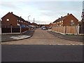
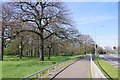
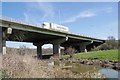
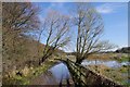
28 photos from this area
Area Information
Key information about the RM15 6AU including its size, population, and administrative classification.
- Area Type
- Postcode
- Area Size
- 3.5 hectares
- Population
- 1915
- Population Density
- 6832 people/km²
House Prices in RM15 6AU
33
Properties
£143,083
Average Sold Price
£98,000
Lowest Price
£175,000
Highest Price
Showing 33 properties
| Address | Type | Beds | Baths | Last Sale Price | Last Sale Date | |
|---|---|---|---|---|---|---|
| 34 Clayburn Gardens, South Ockendon, RM15 6AU | Flat | - | - | £143,000 | May 2024 | |
| 37 Clayburn Gardens, South Ockendon, RM15 6AU | Flat | - | - | £143,000 | Dec 2021 | |
| 60 Clayburn Gardens, South Ockendon, RM15 6AU | Flat | - | - | £147,500 | Apr 2021 | |
| 55 Clayburn Gardens, South Ockendon, RM15 6AU | Flat | - | - | £152,000 | Dec 2018 | |
| 51 Clayburn Gardens, South Ockendon, RM15 6AU | Flat | 2 | 1 | £175,000 | Mar 2018 | |
| 65 Clayburn Gardens, South Ockendon, RM15 6AU | Flat | 1 | - | £98,000 | Jan 2015 | |
| 45 Clayburn Gardens, South Ockendon, RM15 6AU | Flat | 2 | 1 | - | - | |
| 62 Clayburn Gardens, South Ockendon, RM15 6AU | Flat | - | - | - | - | |
| 58 Clayburn Gardens, South Ockendon, RM15 6AU | Flat | - | - | - | - | |
| 61 Clayburn Gardens, South Ockendon, RM15 6AU | Flat | - | - | - | - |
Page 1 of 4
Energy Efficiency in RM15 6AU
Amenities
Schools
| Rank | School | Type | Entry gender | Ages |
|---|
Explore more schools in this area
Go to Schools tabDemographics
Household Size
Family (3-5 people)
most common
Accommodation Type
Houses
most common
Tenure
55
majority
Ethnic Group
White
most common
Religion
N/A
most common
Household Composition
N/A
most common
Age
47
median
Adults (30-64 years)
most common
Household Deprivation
N/A
with no deprivation
NS-SEC
23
in Lower managerial occupations
Explore more demographic insights in this area
Go to Demographics tabPlanning
Planning Constraints
- Flood RiskPremium
- Ramsar Wetland SitesPremium
- Area of Outstanding Natural BeautyPremium
- Protected Nature ReservePremium
- Protected WoodlandPremium