Area Overview for PE6 9EP
Photos of PE6 9EP
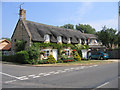
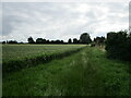
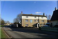
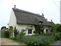
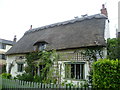
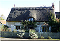
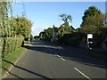
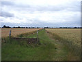
12 photos from this area
Area Information
Key information about the PE6 9EP including its size, population, and administrative classification.
- Area Type
- Postcode
- Area Size
- 23.4 hectares
- Population
- 1591
- Population Density
- 256 people/km²
House Prices in PE6 9EP
28
Properties
£405,955
Average Sold Price
£155,000
Lowest Price
£620,000
Highest Price
Showing 28 properties
| Address | Type | Beds | Baths | Last Sale Price | Last Sale Date | |
|---|---|---|---|---|---|---|
| 10 Castle End Road, Maxey, PE6 9EP | Detached | 4 | 2 | £495,000 | May 2025 | |
| 21 Castle End Road, Maxey, PE6 9EP | house | 4 | 1 | £500,000 | Aug 2023 | |
| Cherry Tree House, 13 Castle End Road, Maxey, PE6 9EP | Detached | 4 | 2 | £620,000 | May 2023 | |
| 25 Castle End Road, Maxey, PE6 9EP | Retail | 2 | 1 | £380,000 | Aug 2022 | |
| 4 Castle End Road, Maxey, PE6 9EP | Bungalow | - | - | £268,000 | Nov 2020 | |
| 15 Castle End Road, Maxey, PE6 9EP | house | - | - | £470,000 | Nov 2018 | |
| 16 Castle End Road, Maxey, PE6 9EP | Bungalow | 2 | - | £392,500 | Nov 2018 | |
| 2 Castle End Road, Maxey, PE6 9EP | Bungalow | - | - | £185,000 | Mar 2017 | |
| 9B Castle End Road, Maxey, PE6 9EP | Retail | 4 | 2 | £500,000 | Sep 2012 | |
| 17 Castle End Road, Maxey, PE6 9EP | Detached | - | - | £155,000 | Mar 2007 |
Page 1 of 3
Energy Efficiency in PE6 9EP
Amenities
Schools
| Rank | School | Type | Entry gender | Ages |
|---|
Explore more schools in this area
Go to Schools tabDemographics
Household Size
Two person
most common
Accommodation Type
Houses
most common
Tenure
92
majority
Ethnic Group
White
most common
Religion
N/A
most common
Household Composition
N/A
most common
Age
47
median
Adults (30-64 years)
most common
Household Deprivation
N/A
with no deprivation
NS-SEC
39
in Lower managerial occupations
Explore more demographic insights in this area
Go to Demographics tabPlanning
Planning Constraints
- Flood RiskPremium
- Ramsar Wetland SitesPremium
- Area of Outstanding Natural BeautyPremium
- Protected Nature ReservePremium
- Protected WoodlandPremium