Area Overview for PE6 9EJ
Photos of PE6 9EJ
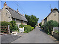
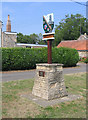
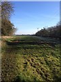
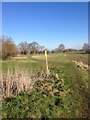
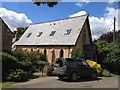

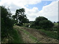
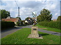
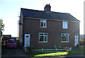
26 photos from this area
Area Information
Key information about the PE6 9EJ including its size, population, and administrative classification.
- Area Type
- Postcode
- Area Size
- 15.2 hectares
- Population
- 1111
- Population Density
- 87 people/km²
House Prices in PE6 9EJ
52
Properties
£400,156
Average Sold Price
£50,000
Lowest Price
£1,100,000
Highest Price
Showing 52 properties
| Address | Type | Beds | Baths | Last Sale Price | Last Sale Date | |
|---|---|---|---|---|---|---|
| 34 West End Road, Maxey, PE6 9EJ | Detached | 4 | 3 | £537,500 | Nov 2025 | |
| 41 West End Road, Maxey, PE6 9EJ | Detached | 4 | 1 | £1,100,000 | Nov 2024 | |
| The Old Vicarage, 10 West End Road, Maxey, PE6 9EJ | Detached | 3 | 4 | £710,000 | Apr 2024 | |
| 22 West End Road, Maxey, PE6 9EJ | house | - | - | £640,000 | Feb 2024 | |
| 40 West End Road, Maxey, PE6 9EJ | house | - | - | £386,000 | Dec 2023 | |
| 2A West End Road, Maxey, PE6 9EJ | Semi-detached | 2 | 1 | £230,000 | Jun 2023 | |
| Endenholme, 24 West End Road, Maxey, PE6 9EJ | house | - | - | £630,000 | Nov 2022 | |
| 10A West End Road, Maxey, PE6 9EJ | Detached | 6 | 2 | £622,500 | Oct 2022 | |
| 18A West End Road, Maxey, PE6 9EJ | house | - | - | £575,000 | Mar 2022 | |
| 27 West End Road, Maxey, PE6 9EJ | house | 4 | - | £426,000 | Jan 2022 |
Page 1 of 6
Energy Efficiency in PE6 9EJ
Amenities
Schools
| Rank | School | Type | Entry gender | Ages |
|---|
Explore more schools in this area
Go to Schools tabDemographics
Household Size
Two person
most common
Accommodation Type
Houses
most common
Tenure
85
majority
Ethnic Group
White
most common
Religion
N/A
most common
Household Composition
N/A
most common
Age
47
median
Adults (30-64 years)
most common
Household Deprivation
N/A
with no deprivation
NS-SEC
42
in Lower managerial occupations
Explore more demographic insights in this area
Go to Demographics tabPlanning
Planning Constraints
- Flood RiskPremium
- Ramsar Wetland SitesPremium
- Area of Outstanding Natural BeautyPremium
- Protected Nature ReservePremium
- Protected WoodlandPremium