Area Overview for PE6 9EF
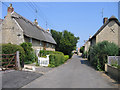
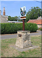
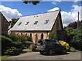
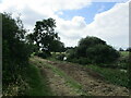
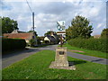
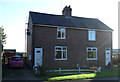
Photos of PE6 9EF


Area Information
Living in PE6 9EF offers a quiet residential experience defined by low density and a strong sense of community. This specific postcode covers a small cluster of homes spread over just 1507 square metres of land. With a total population of 1111 residents, the area feels intimate and manageable rather than urban or congested. A population density of 87 people per square kilometre confirms that the neighbourhood avoids overcrowding, providing residents with open spaces and reduced traffic pressures. The demographic profile indicates that the majority of inhabitants are adults aged between 30 and 64 years. This steady age group suggests a stable community where long-term families and established households reside. You will find that daily life here is characterised by routine and calm, without the rush often associated with larger towns. The layout supports a pace of life where neighbours know one another and the local environment remains tranquil. Prospective buyers seeking a slice of England away from the bustle will appreciate the controlled scale of this residential zone. It is a place where the focus remains on domestic life without the distractions of a high-density city centre.
- Area Type
- Postcode
- Area Size
- 1507 m²
- Population
- 1111
- Population Density
- 87 people/km²
Homes in PE6 9EF are characterised by a very distinct market profile driven by high ownership rates. With 85 per cent of residents owning their property, the area functions primarily as a long-term home base for current owners rather than a rental hotspot. The accommodation type is overwhelmingly houses, meaning buyers looking for flats or apartments will find few options within this specific postcode. This mix suggests a market geared towards family buyers, empty nesters, or retirees who have secured their tenure. The high ownership percentage often correlates with careful property maintenance and a slower pace of buying and selling. When assessing potential purchases, you might encounter a market where vendors have a strong emotional and financial stake in retaining their homes. This dynamic can sometimes slow down transaction speeds compared to rental-heavy zones where landlords rotate tenants frequently. For those considering buying in PE6 9EF, the landscape is defined by existing homeowners looking for the right match rather than speculators flipping houses. The scarcity of rental stock reinforces the idea that this is a place for staying rather than passing through.
House Prices in PE6 9EF
Showing 2 properties
| Address | Type | Beds | Baths | Last Sale Price | Last Sale Date | |
|---|---|---|---|---|---|---|
| 49 High Street, Maxey, PE6 9EF | Detached | - | - | - | - | |
| Shaws Of Maxey, High Street, Maxey, PE6 9EF | Industrial | - | - | - | - |
Energy Efficiency in PE6 9EF
Your daily convenience in PE6 9EF relies on a small selection of amenities located within practical reach of the residential cluster. There are five retail venues nearby, including branches of the Co-op Market and a Tesco Market, ensuring you can handle most daily shopping needs without travelling far. A dedicated Bus Interchange supports bus travel to wider destinations, connecting the area to the broader transport network. While the range of dining or leisure options is modest, the presence of supermarkets allows you to grab groceries and essentials quickly on the way home. The area lacks the complexity of a town centre, but the essentials are invariably close enough to warrant a short walk or a quick drive. This setup suits those who prefer a self-contained lifestyle where most errands can be managed locally. You will find that errands are streamlined because the few key services are concentrated in one convenient location. It is a practical arrangement for families who need reliable shops without the complexity of navigating a sprawling commercial district.
Amenities
Schools
| Rank | School | Type | Entry gender | Ages |
|---|
Explore more schools in this area
Go to Schools tabDemographics
The community within PE6 9EF is dominated by adults, with the most common age range falling between 30 and 64 years. This profile points to a settlement populated by established families rather than young professionals or retirees. Home ownership stands at an impressive 85 per cent, indicating that nearly nine out of ten residents have bought their properties outright or through a mortgage. This high rate of ownership reflects a deep local attachment and financial stability among the population. Almost exclusively, the accommodation type consists of houses, meaning you will encounter detached or semi-detached homes rather than flats or apartments. The predominant ethnic group is White, shaping the cultural fabric of the neighbourhood. These facts combine to create a traditional English residential setting where stability is the norm. The lack of significant youth or elderly demographics suggests fewer related social services are needed compared to areas with wider age spreads. Instead, the area thrives on the contributions of the working-age population who remain in their homes for the long term. You can expect a neighbourly environment where property values are likely protected by this consistent tenure structure.
Household Size
Accommodation Type
Tenure
Ethnic Group
Religion
Household Composition
Age
Household Deprivation
NS-SEC
Explore more demographic insights in this area
Go to Demographics tabPlanning
Planning Constraints
- Flood RiskPremium
- Ramsar Wetland SitesPremium
- Area of Outstanding Natural BeautyPremium
- Protected Nature ReservePremium
- Protected WoodlandPremium