Area Overview for PE6 7DW
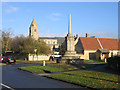
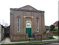
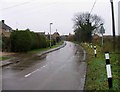
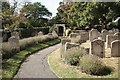
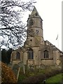
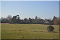
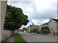
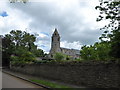
Photos of PE6 7DW
Area Information
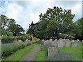
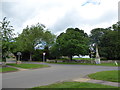
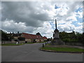
Living in PE6 7DW offers a quiet residential experience within a small, defined cluster covering just 2.1 hectares. This specific postcode area accommodates a population of 1,999 people, resulting in a population density of 74 people per square kilometre. The scale is intimate, fostering a neighbourhood where residents are likely to know one another. Daily life centres on a low floor-level of activity, away from the noise of heavy traffic or large commercial hubs. You enjoy a sense of space despite the compact footprint of the postcode boundary. The environment is stable and established, catering to those who prioritise stillness over constant urban stimulation. Surrounding infrastructure remains within practical reach, ensuring you do not live in isolation while retaining a village-like character. This cluster stands as a distinct entity in the wider Peterborough landscape, offering a specific slice of home ownership and community life. The area represents a mature choice for those seeking a settled place to raise a family or retire in peace.
- Area Type
- Postcode
- Area Size
- 2.1 hectares
- Population
- 1999
- Population Density
- 74 people/km²
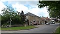
The housing stock in PE6 7DW is overwhelmingly characterised by houses, consistent with the local demand for single-family homes. Eighty-four per cent of residents own their homes, which positions this postcode as a firmly owner-occupied market. You are unlikely to encounter private sector rentals within this specific 2.1-hectare cluster. The prevalence of house ownership indicates that buying a property here represents a significant long-term investment for family security. Prospective buyers should expect a market driven by those seeking to settle in rather than those looking for short-term leases. This high ownership rate often correlates with younger companies with longer tenures and better access to local estate agents and services. The mix of properties will reflect the needs of adults aged 30 to 64 years, as this is the most common age range in the area. You may find a variety of house types from the early 20th century to more recent builds, though the dominance of houses remains the defining feature. The market is not characterised by speculative flipping or high-turnover developments.
House Prices in PE6 7DW
Showing 2 properties
| Address | Type | Beds | Baths | Last Sale Price | Last Sale Date | |
|---|---|---|---|---|---|---|
| Birch View, Golden Drop, Helpston, PE6 7DW | Detached | 4 | - | £430,800 | Aug 2015 | |
| The Tasman, Golden Drop, Helpston, PE6 7DW | house | - | - | - | - |
Energy Efficiency in PE6 7DW
Residents of PE6 7DW enjoy immediate access to five retail outlets, specifically three Co-operative stores located at Werrington, Market, and another Market branch. These shops provide essential groceries and daily necessities without requiring a long drive. Public transport is conveniently located nearby, with four metro stations at Wansford, Ferry Meadows, and Orton Mere acting as local hubs. For longer journeys, two railway stations at Peterborough and Stamford offer regular connections across the country. One airport, RAF Wittering, sits within the region, simplifying business travel and holidays. The lifestyle here is defined by practical convenience and proximity to regional centres rather than extensive on-site leisure facilities. You will find that your weekly shopping errands fall comfortably within walking or short driving distance. The area lacks a formal list of dining venues or major parks within the immediate postcode, meaning you plan your social activities slightly further afield. This proximity to major stations allows you to balance a quiet local life with effortless access to wider cultural and recreational opportunities in southern Peterborough and Stamford.
Amenities
Schools
Families living in PE6 7DW have access to John Clare Primary School for their children's education. This institution serves as the key educational provision for the local cluster. The school operates as a primary facility, catering to pupils up to the end of their compulsory full-time education. Ofsted ratings for the specific school are determined by government inspections, ensuring you are aware of educational quality standards. The presence of this single named school suggests a focused neighbourhood for younger children, rather than a diverse mix of secondary options immediately on the doorstep. Parents must consider transport arrangements for secondary education outside the immediate vicinity. The reliance on John Clare Primary School means parents look to bus routes or walking paths that connect their homes near the postcode to the main campus. This educational setting is a central pillar for the 1,999 residents living in this area. You should verify current admission numbers and catchment boundaries directly with the school enrolment team before making final decisions regarding relocation for educational purposes.
| Rank | School | Type | Entry gender | Ages |
|---|
Explore more schools in this area
Go to Schools tabDemographics
The community within PE6 7DW is defined by a mature age profile, with a median age of 47 years. The most common age range falls between 30 and 64 years, indicating an area populated by adults in their prime working years and beyond. Home ownership is the norm, with 84 per cent of households owning their property outright or with a mortgage. This high level of tenure suggests a stable community with long-term residents rather than a transient rental market. Accommodation types consist primarily of houses, aligning with the preferences of families and retirees alike. The predominant ethnic group is White, reflecting the broader demographic trends of established English neighbourhoods. You will find a community where neighbours have likely lived in their homes for decades, creating deep-rooted social connections. This demographic mix supports local businesses that cater to consistent, long-term customers. The area does not display significant recent population surges or shifts. Instead, it maintains a steady composition of established residents who value stability and local continuity.
Household Size
Accommodation Type
Tenure
Ethnic Group
Religion
Household Composition
Age
Household Deprivation
NS-SEC
Explore more demographic insights in this area
Go to Demographics tabPlanning
Planning Constraints
- Flood RiskPremium
- Ramsar Wetland SitesPremium
- Area of Outstanding Natural BeautyPremium
- Protected Nature ReservePremium
- Protected WoodlandPremium