Area Overview for PE38 0EN
Photos of PE38 0EN

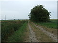
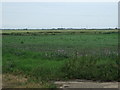


5 photos from this area
Area Information
Key information about the PE38 0EN including its size, population, and administrative classification.
- Area Type
- Postcode
- Area Size
- 67.9 hectares
- Population
- 2434
- Population Density
- 39 people/km²
House Prices in PE38 0EN
15
Properties
£224,929
Average Sold Price
£59,000
Lowest Price
£430,000
Highest Price
Showing 15 properties
| Address | Type | Beds | Baths | Last Sale Price | Last Sale Date | |
|---|---|---|---|---|---|---|
| The Manse, Engine Road, Ten Mile Bank, PE38 0EN | Detached | 3 | - | £215,000 | Dec 2016 | |
| The Old Pump House, Engine Road, Ten Mile Bank, PE38 0EN | Detached | 4 | 3 | £430,000 | Jun 2015 | |
| Lily Cottage, Engine Road, Ten Mile Bank, PE38 0EN | Detached | 3 | 1 | £100,000 | Jun 2008 | |
| Hawthorne House, Engine Road, Ten Mile Bank, PE38 0EN | Detached | - | - | £388,000 | Oct 2007 | |
| Digswell House, Engine Road, Ten Mile Bank, PE38 0EN | Detached | - | - | £245,000 | Jan 2006 | |
| Magnolia Cottage, Engine Road, Ten Mile Bank, PE38 0EN | Detached | - | - | £137,500 | Jul 2003 | |
| Natura Lea, Engine Road, Ten Mile Bank, PE38 0EN | Detached | - | - | £59,000 | Mar 1997 | |
| 4, Fairview Cottages, Engine Road, Ten Mile Bank, PE38 0EN | Semi-detached | 3 | 1 | - | - | |
| 3, Fairview Cottages, Engine Road, Ten Mile Bank, PE38 0EN | Semi-detached | 3 | - | - | - | |
| Jasmine Cottage, Engine Road, Ten Mile Bank, PE38 0EN | Detached | 2 | - | - | - |
Page 1 of 2
Energy Efficiency in PE38 0EN
Amenities
Schools
| Rank | School | Type | Entry gender | Ages |
|---|
Explore more schools in this area
Go to Schools tabDemographics
Household Size
Two person
most common
Accommodation Type
Houses
most common
Tenure
71
majority
Ethnic Group
White
most common
Religion
N/A
most common
Household Composition
N/A
most common
Age
47
median
Adults (30-64 years)
most common
Household Deprivation
N/A
with no deprivation
NS-SEC
27
in Lower managerial occupations
Explore more demographic insights in this area
Go to Demographics tabPlanning
Planning Constraints
- Flood RiskPremium
- Ramsar Wetland SitesPremium
- Area of Outstanding Natural BeautyPremium
- Protected Nature ReservePremium
- Protected WoodlandPremium