Area Overview for PE37 8HY
Photos of PE37 8HY


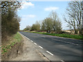
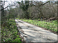
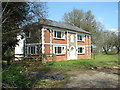

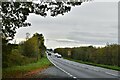
14 photos from this area
Area Information
Key information about the PE37 8HY including its size, population, and administrative classification.
- Area Type
- Postcode
- Area Size
- 86.2 hectares
- Population
- 2144
- Population Density
- 139 people/km²
House Prices in PE37 8HY
33
Properties
£173,246
Average Sold Price
£33,000
Lowest Price
£345,000
Highest Price
Showing 33 properties
| Address | Type | Beds | Baths | Last Sale Price | Last Sale Date | |
|---|---|---|---|---|---|---|
| 27 St Andrews Lane, Necton, PE37 8HY | Semi-detached | 3 | 1 | £250,000 | Apr 2024 | |
| 6 St Andrews Lane, Necton, PE37 8HY | house | - | - | £250,000 | Aug 2021 | |
| 24 St Andrews Lane, Necton, PE37 8HY | Bungalow | 3 | 1 | £330,000 | May 2021 | |
| 17 St Andrews Lane, Necton, PE37 8HY | Semi-detached | 3 | 2 | £195,500 | Sep 2020 | |
| 12 St Andrews Lane, Necton, PE37 8HY | Terraced | 3 | 1 | £175,000 | Sep 2017 | |
| 15 St Andrews Lane, Necton, PE37 8HY | Terraced | 3 | - | £171,750 | Feb 2017 | |
| Charnwood, St Andrews Lane, Necton, PE37 8HY | Detached | 4 | 2 | £345,000 | Jun 2012 | |
| 9 St Andrews Lane, Necton, PE37 8HY | house | - | - | £130,000 | Jun 2009 | |
| 20 St Andrews Lane, Necton, PE37 8HY | Detached | - | - | £104,000 | Jun 2000 | |
| 31 St Andrews Lane, Necton, PE37 8HY | Detached | - | - | £47,700 | May 1998 |
Page 1 of 4
Energy Efficiency in PE37 8HY
Amenities
Schools
| Rank | School | Type | Entry gender | Ages |
|---|
Explore more schools in this area
Go to Schools tabDemographics
Household Size
Two person
most common
Accommodation Type
Houses
most common
Tenure
78
majority
Ethnic Group
White
most common
Religion
N/A
most common
Household Composition
N/A
most common
Age
47
median
Adults (30-64 years)
most common
Household Deprivation
N/A
with no deprivation
NS-SEC
26
in Lower managerial occupations
Explore more demographic insights in this area
Go to Demographics tabPlanning
Planning Constraints
- Flood RiskPremium
- Ramsar Wetland SitesPremium
- Area of Outstanding Natural BeautyPremium
- Protected Nature ReservePremium
- Protected WoodlandPremium