Area Overview for PE37 8EJ
Photos of PE37 8EJ
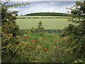
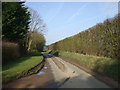
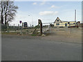
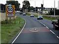
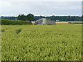

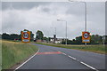
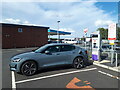
15 photos from this area
Area Information
Key information about the PE37 8EJ including its size, population, and administrative classification.
- Area Type
- Postcode
- Area Size
- 1.8 hectares
- Population
- 2144
- Population Density
- 139 people/km²
House Prices in PE37 8EJ
18
Properties
£117,821
Average Sold Price
£28,000
Lowest Price
£248,000
Highest Price
Showing 18 properties
| Address | Type | Beds | Baths | Last Sale Price | Last Sale Date | |
|---|---|---|---|---|---|---|
| 17 St Andrews Way, Necton, PE37 8EJ | Bungalow | 2 | - | £164,000 | Mar 2025 | |
| 1 St Andrews Way, Necton, PE37 8EJ | Bungalow | 3 | 1 | £248,000 | Sep 2022 | |
| 7 St Andrews Way, Necton, PE37 8EJ | Terraced | - | - | £90,000 | Feb 2021 | |
| 9 St Andrews Way, Necton, PE37 8EJ | Bungalow | 1 | 1 | £130,000 | Sep 2019 | |
| 10 St Andrews Way, Necton, PE37 8EJ | Bungalow | 1 | 1 | £120,000 | Jul 2018 | |
| 4 St Andrews Way, Necton, PE37 8EJ | Bungalow | 2 | 1 | £149,000 | May 2018 | |
| 5 St Andrews Way, Necton, PE37 8EJ | Terraced | 1 | 1 | £129,950 | Nov 2017 | |
| 12 St Andrews Way, Necton, PE37 8EJ | Bungalow | 1 | - | £100,000 | May 2017 | |
| 11 St Andrews Way, Necton, PE37 8EJ | Bungalow | 1 | - | £105,000 | Jul 2016 | |
| 13 St Andrews Way, Necton, PE37 8EJ | Terraced | 1 | - | £115,000 | Sep 2015 |
Page 1 of 2
Energy Efficiency in PE37 8EJ
Amenities
Schools
| Rank | School | Type | Entry gender | Ages |
|---|
Explore more schools in this area
Go to Schools tabDemographics
Household Size
Two person
most common
Accommodation Type
Houses
most common
Tenure
78
majority
Ethnic Group
White
most common
Religion
N/A
most common
Household Composition
N/A
most common
Age
47
median
Adults (30-64 years)
most common
Household Deprivation
N/A
with no deprivation
NS-SEC
26
in Lower managerial occupations
Explore more demographic insights in this area
Go to Demographics tabPlanning
Planning Constraints
- Flood RiskPremium
- Ramsar Wetland SitesPremium
- Area of Outstanding Natural BeautyPremium
- Protected Nature ReservePremium
- Protected WoodlandPremium