Area Overview for PE34 4HW
Photos of PE34 4HW
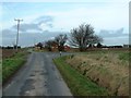
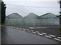
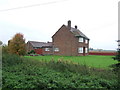
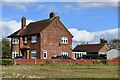
17 photos from this area
Area Information
Key information about the PE34 4HW including its size, population, and administrative classification.
- Area Type
- Postcode
- Area Size
- 19.1 hectares
- Population
- 1559
- Population Density
- 39 people/km²
House Prices in PE34 4HW
10
Properties
£224,179
Average Sold Price
£32,750
Lowest Price
£475,000
Highest Price
Showing 10 properties
| Address | Type | Beds | Baths | Last Sale Price | Last Sale Date | |
|---|---|---|---|---|---|---|
| Thistledown, 41 Craske Lane, Terrington St Clement, PE34 4HW | Retail | 4 | 2 | £365,000 | Apr 2022 | |
| 19 Craske Lane, Terrington St Clement, PE34 4HW | house | - | - | £215,000 | Nov 2017 | |
| Craske Cottages, 43 Craske Lane, Terrington St Clement, PE34 4HW | Terraced | 2 | 2 | £168,500 | Aug 2017 | |
| Wild Wood, 47 Craske Lane, Terrington St Clement, PE34 4HW | house | 3 | - | £215,000 | Oct 2016 | |
| The Meadows, 31 Craske Lane, Terrington St Clement, PE34 4HW | Bungalow | 5 | - | £475,000 | Jul 2012 | |
| September Cottage, 45 Craske Lane, Terrington St Clement, PE34 4HW | house | - | - | £98,000 | Dec 2006 | |
| Craske Cottages, 37 Craske Lane, Terrington St Clement, PE34 4HW | Terraced | - | - | £32,750 | May 1996 | |
| 21 Craske Lane, Terrington St Clement, PE34 4HW | Semi-detached | 3 | - | - | - | |
| 39 Craske Lane, Terrington St Clement, PE34 4HW | Terraced | - | - | - | - | |
| Dwelling, Craske Lane, Terrington St Clement, PE34 4HW | undefined | - | - | - | - |
Energy Efficiency in PE34 4HW
Amenities
Schools
| Rank | School | Type | Entry gender | Ages |
|---|
Explore more schools in this area
Go to Schools tabDemographics
Household Size
Family (3-5 people)
most common
Accommodation Type
Houses
most common
Tenure
60
majority
Ethnic Group
White
most common
Religion
N/A
most common
Household Composition
N/A
most common
Age
47
median
Adults (30-64 years)
most common
Household Deprivation
N/A
with no deprivation
NS-SEC
20
in Lower managerial occupations
Explore more demographic insights in this area
Go to Demographics tabPlanning
Planning Constraints
- Flood RiskPremium
- Ramsar Wetland SitesPremium
- Area of Outstanding Natural BeautyPremium
- Protected Nature ReservePremium
- Protected WoodlandPremium