Area Overview for PE34 4HA
Photos of PE34 4HA
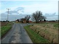

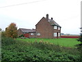
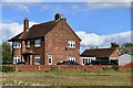
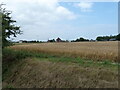
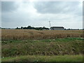
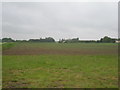

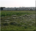
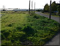

17 photos from this area
Area Information
Key information about the PE34 4HA including its size, population, and administrative classification.
- Area Type
- Postcode
- Area Size
- 73.8 hectares
- Population
- 2506
- Population Density
- 108 people/km²
House Prices in PE34 4HA
24
Properties
£209,107
Average Sold Price
£49,000
Lowest Price
£452,000
Highest Price
Showing 24 properties
| Address | Type | Beds | Baths | Last Sale Price | Last Sale Date | |
|---|---|---|---|---|---|---|
| 1 Low Road, Walpole Cross Keys, PE34 4HA | Detached | 2 | 1 | £270,000 | Oct 2025 | |
| Comino, Low Road, Walpole Cross Keys, PE34 4HA | Bungalow | 3 | 1 | £340,500 | Mar 2025 | |
| Last View, Low Road, Walpole Cross Keys, PE34 4HA | Detached | 3 | 1 | £452,000 | Feb 2024 | |
| Willow View, Low Road, Walpole Cross Keys, PE34 4HA | house | - | - | £405,000 | Nov 2021 | |
| Lion House, Low Road, Walpole Cross Keys, PE34 4HA | house | - | - | £260,000 | Sep 2017 | |
| The Firs, Low Road, Walpole Cross Keys, PE34 4HA | Bungalow | - | - | £100,000 | Jul 2016 | |
| Highbank, Low Road, Walpole Cross Keys, PE34 4HA | Bungalow | 2 | 1 | £124,000 | Mar 2015 | |
| Bank House, Low Road, Walpole Cross Keys, PE34 4HA | Cottage | 3 | - | £250,000 | Oct 2014 | |
| Halcyon, 7 Low Road, Walpole Cross Keys, PE34 4HA | Detached | 2 | - | £127,500 | Feb 2013 | |
| Westfields, Low Road, Walpole Cross Keys, PE34 4HA | Bungalow | 3 | 1 | £185,000 | Nov 2012 |
Page 1 of 3
Energy Efficiency in PE34 4HA
Amenities
Schools
| Rank | School | Type | Entry gender | Ages |
|---|
Explore more schools in this area
Go to Schools tabDemographics
Household Size
Two person
most common
Accommodation Type
Houses
most common
Tenure
80
majority
Ethnic Group
White
most common
Religion
N/A
most common
Household Composition
N/A
most common
Age
47
median
Adults (30-64 years)
most common
Household Deprivation
N/A
with no deprivation
NS-SEC
27
in Lower managerial occupations
Explore more demographic insights in this area
Go to Demographics tabPlanning
Planning Constraints
- Flood RiskPremium
- Ramsar Wetland SitesPremium
- Area of Outstanding Natural BeautyPremium
- Protected Nature ReservePremium
- Protected WoodlandPremium