Area Overview for PE34 3NU
Photos of PE34 3NU
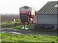

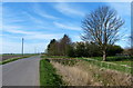
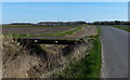
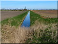
20 photos from this area
Area Information
Key information about the PE34 3NU including its size, population, and administrative classification.
- Area Type
- Postcode
- Area Size
- 84.2 hectares
- Population
- 1682
- Population Density
- 39 people/km²
House Prices in PE34 3NU
9
Properties
£253,250
Average Sold Price
£106,500
Lowest Price
£400,000
Highest Price
Showing 9 properties
| Address | Type | Beds | Baths | Last Sale Price | Last Sale Date | |
|---|---|---|---|---|---|---|
| Briar Cottage, Outwell Road, Stow Bridge, PE34 3NU | Semi-detached | 3 | 1 | £106,500 | Jun 2024 | |
| Mortons Farm, Outwell Road, Stow Bridge, PE34 3NU | house | - | - | £400,000 | Feb 2021 | |
| Fenland Lodge, Outwell Road, Stow Bridge, PE34 3NU | undefined | - | - | - | - | |
| Franks Farm, Outwell Road, Stow Bridge, PE34 3NU | house | - | - | - | - | |
| Fences Farm West, Outwell Road, Stow Bridge, PE34 3NU | house | - | - | - | - | |
| Bramble Cottage, Outwell Road, Stow Bridge, PE34 3NU | Semi-detached | - | - | - | - | |
| Storage Depot At, Stow Road Farm, Outwell Road, Stow Bridge, PE34 3NU | warehouse | - | - | - | - | |
| Newlings Farm, Outwell Road, Stow Bridge, PE34 3NU | house | - | - | - | - | |
| New Bridge Farm, Outwell Road, Stow Bridge, PE34 3NU | house | - | - | - | - |
Energy Efficiency in PE34 3NU
Amenities
Schools
| Rank | School | Type | Entry gender | Ages |
|---|
Explore more schools in this area
Go to Schools tabDemographics
Household Size
Two person
most common
Accommodation Type
Houses
most common
Tenure
75
majority
Ethnic Group
White
most common
Religion
N/A
most common
Household Composition
N/A
most common
Age
47
median
Adults (30-64 years)
most common
Household Deprivation
N/A
with no deprivation
NS-SEC
28
in Lower managerial occupations
Explore more demographic insights in this area
Go to Demographics tabPlanning
Planning Constraints
- Flood RiskPremium
- Ramsar Wetland SitesPremium
- Area of Outstanding Natural BeautyPremium
- Protected Nature ReservePremium
- Protected WoodlandPremium