Area Overview for PE34 3NJ
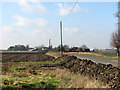
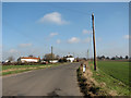
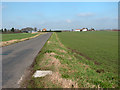
Photos of PE34 3NJ


Area Information
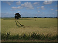
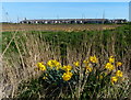
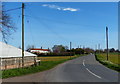
Living in PE34 3NJ means residing in a compact residential cluster covering 25.2 hectares. This specific postcode area accommodates a population of 1,682 people, resulting in a low density of 39 inhabitants per square kilometre. The setting offers a quiet residential experience far removed from the congestion of urban centres. You are aware immediately that this is a small, defined community rather than a sprawling suburb. The area focuses entirely on housing needs without the complexity of mixed commercial or industrial use. Daily life here revolves around a stable environment where residents enjoy wide-open spaces and reduced noise levels. The population profile suggests a mature neighbourhood character, with most residents falling into adult categories. You find a tight-knit community where neighbours know one another, supported by the relatively low population spread across the land. This postcode represents a specific slice of rural or semi-rural England where pace moderates significantly compared to major towns. The geography dictates a relaxed lifestyle centred on home life and local connectivity. Buyers interested in this location see a clear trade-off between density and tranquillity. The area stands as a distinct residential option within the PE34 postcode district, offering stability for those seeking a grounded property search.
- Area Type
- Postcode
- Area Size
- 25.2 hectares
- Population
- 1682
- Population Density
- 39 people/km²
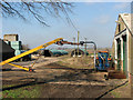
The property market in PE34 3NJ is characterised by a dominant stock of traditional houses rather than attached or high-density dwellings. You will find that 75% of homes in this postcode are owner-occupied, distinguishing it from rental-heavy urban districts. This high ownership rate suggests that most properties are passed down or bought into by permanent residents. The accommodation type is exclusively houses, meaning you will not find flats or converted apartments as standard options. This is a market for detached, semi-detached, or terraced family homes with private gardens. Buyers looking at PE34 3NJ should understand that they are entering a low-density, owner-led market. The sheer number of properties for sale may be limited compared to larger settlements due to the small population of 1,682 and the 25.2 hectare footprint. Competition for housing tends to be quiet because the total supply is restricted by the physical size of the area. You are likely to compete against other serious buyers seeking stability in a mature location. Prices may reflect the convenience of house ownership and the lower maintenance requirements of established housing stock. Investment potential hinges on the scarcity of newer developments willing to expand beyond the current residential cluster. This market suits those who value privacy and established neighbourhood values over urban convenience or rental yields.
House Prices in PE34 3NJ
Showing 1 properties
| Address | Type | Beds | Baths | Last Sale Price | Last Sale Date | |
|---|---|---|---|---|---|---|
| West Head Farm, West Head Road, Stow Bridge, PE34 3NJ | Detached | - | - | - | - |
Energy Efficiency in PE34 3NJ
Residents of PE34 3NJ enjoy practical access to essential amenities without needing to travel far. You can shop for groceries and household goods at Morrisons Downham, Iceland Downham, and Tesco Downham. These three major retailers form the backbone of daily shopping needs for the local population. The area offers five key retail locations within practical reach, ensuring you do not need long commutes for basic supplies. Transport links include two railway stations, Downham Market Railway Station and Watlington Railway Station, which facilitate travel to nearby towns and beyond. Beyond shopping and rail, the immediate lifestyle is defined by residential ease and quiet surroundings. There is no data provided for parks, leisure centres, hospitals, or restaurants in this specific breakdown. Your leisure time likely centres on the 25.2 hectares of residential land where you live or appeals to the 30-64 year age group outdoors. The presence of White residents suggests a familiarity with local traditions and community events. You might find social ties strengthen through local occurrences rather than large commercial hubs. The five retail outlets and two rail stations provide the core infrastructure, leaving the rest of the weekend to personal preference and the quiet character of the neighbourhood.
Amenities
Schools
The educational landscape near PE34 3NJ is anchored by Barroway Drove Primary School. This institution serves as the primary educational facility for young children in the immediate vicinity. You should note that the data confirms only one primary school is listed for this specific postcode area. There is no secondary school data provided in the immediate neighbourhood profile for PE34 3NJ. This means older children typically transfer to facilities further away or within the broader Downham Market or Watlington catchment areas. For families with young children, Barroway Drove Primary School offers local access without the need for secondary travel arrangements. The presence of a single primary option implies a concentrated catchment area around the school. You must check individual admission criteria and transport arrangements with the school directly for your child. Older residents in the 30 to 64 year age range may have already long ago navigated this system, but younger families will need to plan carefully for secondary education phases. The proximity to Barroway Drove Primary School remains the key selling point for school-run logistics near this postcode. Parents in PE34 3NJ should factor in travel time to outside areas for comprehensive or high school education.
| Rank | School | Type | Entry gender | Ages |
|---|
Explore more schools in this area
Go to Schools tabDemographics
The community in PE34 3NJ is defined by a mature population structure with a median age of 47 years. You will find that the most common age range consists of adults between 30 and 64 years. This demographic skew indicates a neighbourhood populated by established individuals and families rather than young professionals or retirees. Home ownership stands at 75%, meaning the majority of residents own their property outright or with a mortgage. This high level of ownership typically correlates with long-term settlement and stability within the community. The accommodation type is exclusively houses, signifying a preference for detached or semi-detached living over flats. This housing form supports larger households and gardens, aligning well with the age profile. The predominant ethnic group is White, reflecting the traditional demographic makeup of this part of England. You can expect a homogenous community where cultural norms are well established. There is no data provided to suggest significant recent migration or demographic shifts away from this profile. The combination of high home ownership and older residents creates a settled atmosphere. Your neighbours are likely to be career-establishment heads of households or those enjoying later life phases. This stability influences local governance, spending habits, and community engagement levels.
Household Size
Accommodation Type
Tenure
Ethnic Group
Religion
Household Composition
Age
Household Deprivation
NS-SEC
Explore more demographic insights in this area
Go to Demographics tabPlanning
Planning Constraints
- Flood RiskPremium
- Ramsar Wetland SitesPremium
- Area of Outstanding Natural BeautyPremium
- Protected Nature ReservePremium
- Protected WoodlandPremium