Area Overview for PE33 9DX
Photos of PE33 9DX
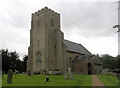
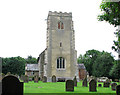
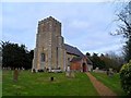

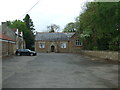
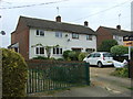
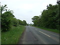
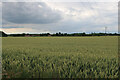
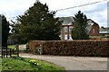
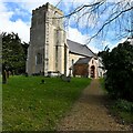
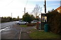
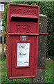
16 photos from this area
Area Information
Key information about the PE33 9DX including its size, population, and administrative classification.
- Area Type
- Postcode
- Area Size
- 51.0 hectares
- Population
- 2602
- Population Density
- 40 people/km²
House Prices in PE33 9DX
57
Properties
£238,341
Average Sold Price
£71,000
Lowest Price
£575,000
Highest Price
Showing 57 properties
| Address | Type | Beds | Baths | Last Sale Price | Last Sale Date | |
|---|---|---|---|---|---|---|
| Adelphi Cottage, Main Road, Crimplesham, PE33 9DX | Detached | 3 | 2 | £382,000 | Jun 2025 | |
| Toppesfield, Main Road, Crimplesham, PE33 9DX | Bungalow | 2 | 1 | £230,000 | Mar 2025 | |
| Shamrock, Main Road, Crimplesham, PE33 9DX | Terraced | 2 | 1 | £165,000 | Jan 2023 | |
| Keri-keri, Main Road, Crimplesham, PE33 9DX | Bungalow | - | - | £575,000 | Jul 2022 | |
| Ruby Cottage, Main Road, Crimplesham, PE33 9DX | Semi-detached | 5 | 2 | £350,000 | Oct 2021 | |
| Yew Cottage, Main Road, Crimplesham, PE33 9DX | Semi-detached | 3 | 2 | £286,000 | Sep 2021 | |
| Rosedene Cottage, Main Road, Crimplesham, PE33 9DX | Cottage | 3 | 2 | £295,000 | Aug 2021 | |
| Horse Shoe Cottage, Main Road, Crimplesham, PE33 9DX | Bungalow | - | - | £350,000 | Jun 2021 | |
| Rosemary Cottage, Main Road, Crimplesham, PE33 9DX | house | - | - | £318,000 | Jan 2021 | |
| Sycamore Cottage, Main Road, Crimplesham, PE33 9DX | Semi-detached | 3 | 2 | £265,000 | Dec 2019 |
Page 1 of 6
Energy Efficiency in PE33 9DX
Amenities
Schools
| Rank | School | Type | Entry gender | Ages |
|---|
Explore more schools in this area
Go to Schools tabDemographics
Household Size
Two person
most common
Accommodation Type
Houses
most common
Tenure
74
majority
Ethnic Group
White
most common
Religion
N/A
most common
Household Composition
N/A
most common
Age
47
median
Adults (30-64 years)
most common
Household Deprivation
N/A
with no deprivation
NS-SEC
32
in Lower managerial occupations
Explore more demographic insights in this area
Go to Demographics tabPlanning
Planning Constraints
- Flood RiskPremium
- Ramsar Wetland SitesPremium
- Area of Outstanding Natural BeautyPremium
- Protected Nature ReservePremium
- Protected WoodlandPremium