Area Overview for PE33 9DU
Photos of PE33 9DU
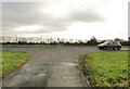
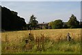
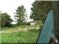
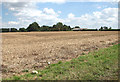
16 photos from this area
Area Information
Key information about the PE33 9DU including its size, population, and administrative classification.
- Area Type
- Postcode
- Area Size
- 96.4 hectares
- Population
- 2602
- Population Density
- 40 people/km²
House Prices in PE33 9DU
12
Properties
£735,000
Average Sold Price
£445,000
Lowest Price
£1,025,000
Highest Price
Showing 12 properties
| Address | Type | Beds | Baths | Last Sale Price | Last Sale Date | |
|---|---|---|---|---|---|---|
| Crimplesham Hall, Downham Road, Crimplesham, PE33 9DU | Detached | 6 | 2 | £1,025,000 | Jun 2021 | |
| Crimplesham Park, Downham Road, Crimplesham, PE33 9DU | Detached | - | - | £445,000 | May 2007 | |
| FLAT 1, CRIMPLESHAM HALL, DOWNHAM ROAD, Crimplesham, PE33 9DU | Flat | 1 | - | - | - | |
| Park Farm, Downham Road, Crimplesham, PE33 9DU | Detached | - | - | - | - | |
| Flat 3, Crimplesham Hall, Downham Road, Crimplesham, PE33 9DU | Flat | - | - | - | - | |
| Flat 2, Crimplesham Hall, Downham Road, Crimplesham, PE33 9DU | Flat | 2 | 1 | - | - | |
| Parklands, Downham Road, Crimplesham, PE33 9DU | Retail | 1 | 1 | - | - | |
| Home Farm, Downham Road, Crimplesham, PE33 9DU | house | - | - | - | - | |
| The Larder At, Crimplesham Hall, Downham Road, Crimplesham, PE33 9DU | Flat | - | - | - | - | |
| The Cottage, Downham Road, Crimplesham, PE33 9DU | house | - | - | - | - |
Page 1 of 2
Energy Efficiency in PE33 9DU
Amenities
Schools
| Rank | School | Type | Entry gender | Ages |
|---|
Explore more schools in this area
Go to Schools tabDemographics
Household Size
Two person
most common
Accommodation Type
Houses
most common
Tenure
74
majority
Ethnic Group
White
most common
Religion
N/A
most common
Household Composition
N/A
most common
Age
47
median
Adults (30-64 years)
most common
Household Deprivation
N/A
with no deprivation
NS-SEC
32
in Lower managerial occupations
Explore more demographic insights in this area
Go to Demographics tabPlanning
Planning Constraints
- Flood RiskPremium
- Ramsar Wetland SitesPremium
- Area of Outstanding Natural BeautyPremium
- Protected Nature ReservePremium
- Protected WoodlandPremium