Area Overview for PE33 9AG
Photos of PE33 9AG
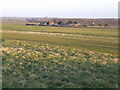
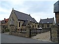
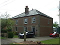
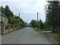
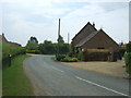
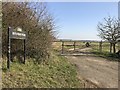
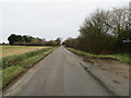
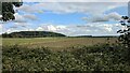
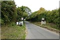
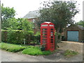
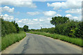
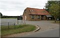
13 photos from this area
Area Information
Key information about the PE33 9AG including its size, population, and administrative classification.
- Area Type
- Postcode
- Area Size
- 5.1 hectares
- Population
- 2559
- Population Density
- 92 people/km²
House Prices in PE33 9AG
23
Properties
£235,100
Average Sold Price
£85,000
Lowest Price
£545,000
Highest Price
Showing 23 properties
| Address | Type | Beds | Baths | Last Sale Price | Last Sale Date | |
|---|---|---|---|---|---|---|
| 2 Chapel Road, Boughton, PE33 9AG | Terraced | 2 | 1 | £220,000 | Dec 2025 | |
| Appletree Cottage, Chapel Road, Boughton, PE33 9AG | Detached | 4 | 2 | £545,000 | Jul 2023 | |
| 1, Poplar Cottages, Chapel Road, Boughton, PE33 9AG | Cottage | 2 | 1 | £174,500 | Jun 2019 | |
| Rose Cottage, Chapel Road, Boughton, PE33 9AG | Terraced | 1 | 1 | £150,000 | Feb 2016 | |
| Old Post Office, Chapel Road, Boughton, PE33 9AG | Terraced | 3 | 1 | £95,000 | Jun 2009 | |
| Gothic Cottage, Chapel Road, Boughton, PE33 9AG | house | - | - | £155,000 | Jun 2005 | |
| Ash Cottage, Chapel Road, Boughton, PE33 9AG | Detached | - | - | £249,000 | Feb 2004 | |
| Tapestry Cottage, Chapel Road, Boughton, PE33 9AG | Detached | - | - | £200,000 | Sep 2003 | |
| Harwins, Chapel Road, Boughton, PE33 9AG | Detached | - | - | £477,500 | Aug 2002 | |
| Sycamore House, Chapel Road, Boughton, PE33 9AG | Semi-detached | - | - | £85,000 | Sep 1999 |
Page 1 of 3
Energy Efficiency in PE33 9AG
Amenities
Schools
| Rank | School | Type | Entry gender | Ages |
|---|
Explore more schools in this area
Go to Schools tabDemographics
Household Size
Two person
most common
Accommodation Type
Houses
most common
Tenure
76
majority
Ethnic Group
White
most common
Religion
N/A
most common
Household Composition
N/A
most common
Age
47
median
Adults (30-64 years)
most common
Household Deprivation
N/A
with no deprivation
NS-SEC
30
in Lower managerial occupations
Explore more demographic insights in this area
Go to Demographics tabPlanning
Planning Constraints
- Flood RiskPremium
- Ramsar Wetland SitesPremium
- Area of Outstanding Natural BeautyPremium
- Protected Nature ReservePremium
- Protected WoodlandPremium