Area Overview for PE33 9AE
Photos of PE33 9AE
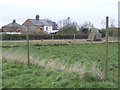
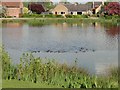


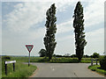
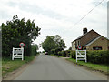
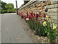

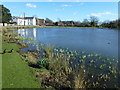
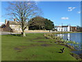
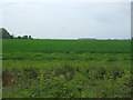
26 photos from this area
Area Information
Key information about the PE33 9AE including its size, population, and administrative classification.
- Area Type
- Postcode
- Area Size
- 86.2 hectares
- Population
- 2559
- Population Density
- 92 people/km²
House Prices in PE33 9AE
37
Properties
£271,401
Average Sold Price
£110,000
Lowest Price
£930,000
Highest Price
Showing 37 properties
| Address | Type | Beds | Baths | Last Sale Price | Last Sale Date | |
|---|---|---|---|---|---|---|
| Hall House, Mill Hill Road, Boughton, PE33 9AE | house | - | - | £930,000 | Jan 2024 | |
| Horsemans Cottage, Mill Hill Road, Boughton, PE33 9AE | house | - | - | £320,000 | Jan 2022 | |
| The Old Field, Mill Hill Road, Boughton, PE33 9AE | house | - | - | £110,000 | Mar 2021 | |
| Jays Cottage, Mill Hill Road, Boughton, PE33 9AE | house | - | - | £230,000 | Aug 2020 | |
| Jubilee Lodge, Mill Hill Road, Boughton, PE33 9AE | Bungalow | 3 | - | £275,000 | Sep 2019 | |
| The Old Stable, Mill Hill Road, Boughton, PE33 9AE | Detached | - | - | £430,000 | Nov 2017 | |
| Fieldview Cottage, Mill Hill Road, Boughton, PE33 9AE | house | - | - | £190,000 | Nov 2016 | |
| Hall Farm, Mill Hill Road, Boughton, PE33 9AE | Bungalow | 3 | - | £195,000 | Oct 2013 | |
| Arcadian, Mill Hill Road, Boughton, PE33 9AE | Detached | 4 | 3 | £228,000 | Aug 2008 | |
| The Bungalow, Mill Hill Road, Boughton, PE33 9AE | Detached | - | - | £185,010 | May 2008 |
Page 1 of 4
Energy Efficiency in PE33 9AE
Amenities
Schools
| Rank | School | Type | Entry gender | Ages |
|---|
Explore more schools in this area
Go to Schools tabDemographics
Household Size
Two person
most common
Accommodation Type
Houses
most common
Tenure
76
majority
Ethnic Group
White
most common
Religion
N/A
most common
Household Composition
N/A
most common
Age
47
median
Adults (30-64 years)
most common
Household Deprivation
N/A
with no deprivation
NS-SEC
30
in Lower managerial occupations
Explore more demographic insights in this area
Go to Demographics tabPlanning
Planning Constraints
- Flood RiskPremium
- Ramsar Wetland SitesPremium
- Area of Outstanding Natural BeautyPremium
- Protected Nature ReservePremium
- Protected WoodlandPremium