Area Overview for PE32 1EL
Photos of PE32 1EL
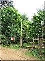
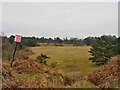
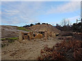
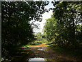
13 photos from this area
Area Information
Key information about the PE32 1EL including its size, population, and administrative classification.
- Area Type
- Postcode
- Area Size
- 90.6 hectares
- Population
- 2462
- Population Density
- 60 people/km²
House Prices in PE32 1EL
13
Properties
£316,000
Average Sold Price
£80,000
Lowest Price
£600,000
Highest Price
Showing 13 properties
| Address | Type | Beds | Baths | Last Sale Price | Last Sale Date | |
|---|---|---|---|---|---|---|
| Appletree Cottage, 20 Holt House Lane, Leziate, PE32 1EL | Detached | 5 | 4 | £600,000 | Feb 2021 | |
| Braeside, 15 Holt House Lane, Leziate, PE32 1EL | Bungalow | 4 | 4 | £565,000 | Aug 2019 | |
| Littleton, 9 Holt House Lane, Leziate, PE32 1EL | Bungalow | - | - | £220,000 | Aug 2010 | |
| Woodlands, 11 Holt House Lane, Leziate, PE32 1EL | house | - | - | £115,000 | Aug 2010 | |
| Wild Wood Cottage, 25 Holt House Lane, Leziate, PE32 1EL | Detached | - | - | £80,000 | Oct 1999 | |
| Highfield, 27 Holt House Lane, Leziate, PE32 1EL | Detached | 4 | 2 | - | - | |
| Tanglewood, 7 Holt House Lane, Leziate, PE32 1EL | Detached | 5 | 2 | - | - | |
| Holt House Farm, Holt House Lane, Leziate, PE32 1EL | house | - | - | - | - | |
| Ground Floor Flat, Holt House, Holt House Lane, Leziate, PE32 1EL | Flat | - | - | - | - | |
| Holt House Cottages (formerly) Now 20, Holt House Lane, Leziate, PE32 1EL | Detached | - | - | - | - |
Page 1 of 2
Energy Efficiency in PE32 1EL
Amenities
Schools
| Rank | School | Type | Entry gender | Ages |
|---|
Explore more schools in this area
Go to Schools tabDemographics
Household Size
Two person
most common
Accommodation Type
Houses
most common
Tenure
70
majority
Ethnic Group
White
most common
Religion
N/A
most common
Household Composition
N/A
most common
Age
47
median
Adults (30-64 years)
most common
Household Deprivation
N/A
with no deprivation
NS-SEC
31
in Lower managerial occupations
Explore more demographic insights in this area
Go to Demographics tabPlanning
Planning Constraints
- Flood RiskPremium
- Ramsar Wetland SitesPremium
- Area of Outstanding Natural BeautyPremium
- Protected Nature ReservePremium
- Protected WoodlandPremium